Losino-Petrovskiy geodata
Losino-Petrovskiy (Moscow Oblast) is a populated place; located in Russia in Europe/Moscow (GMT+3) time zone. With population of 22,116 people, there are 812 cities with bigger population in this country. Compared to other cities in Russia, 64.7% of cities are located further ↓South; 75.8% of cities are located further →East and 50.7% of cities have higher elevation than Losino-Petrovskiy. Note1


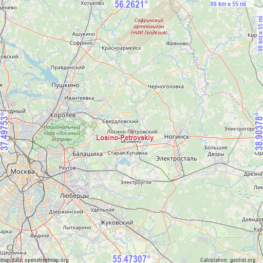
Losino-Petrovskiy GPS coordinates[2]
55° 52' 10.524" North, 38° 12' 2.34" East
| Map corner | latitude | longitude |
|---|---|---|
| Upper-left | 56.2621°, | 37.49753° |
| Center: | 55.86959°, | 38.20065° |
| Lower-right: | 55.47307°, | 38.90378° |
| Map W x H: | 87.7×87.7 km | = 54.5×54.5mi |
| max Lat: | 73.50819° ⇑35.3% North |
| Losino-Petrovskiy: | 55.86959° |
| min Lat: | ⇓64.7% South 41.28413° |
| min Long | Losino-Petrovsk | max Long |
| -179.12198° | 38.20065° | 179.35046° |
| W 24.2%⇐ | ⇒75.8% E |
Elevation
Elevation of Losino-Petrovskiy is 143 m = 469 ft, and this is 59.6 m = 196 ft below average elevation for this country.
| Max E: |
2518 m = 8261 ft | 50.7% |
| Avg. | 202.6 m = 665 ft | |
| Losino-Petrovskiy | 143 m = 469 ft | |
Min E: |
-28 m = -92 ft | 49.3% |
See also: Russia elevation on elevation.city.
Geographical zone
Losino-Petrovskiy is located in North temperate zone (between Tropic of Cancer and the Arctic Circle). Distance of this North polar circle is 1189.1 km =738.9 mi to North.| Distance of | km | miles | from Losino-Petrovskiy |
|---|---|---|---|
| North Pole | 3794.9 | 2358 | to North |
| Arctic Circle | 1189.1 | 738.9 | to North |
| Tropic Cancer | 3606.2 | 2240.8 | to South |
| Equator | 6212.1 | 3860 | to South |


Nearby cities:
15 places around Losino-Petrovskiy: (largest is in red/bold)
• Bakhchivandzhi
7.5 km =4.7 mi,  281°
281°
• Chkalovskiy
8.2 km =5.1 mi,  290°
290°
• Dolgoye Lëdovo
14.2 km =8.8 mi,  266°
266°
• Fryazino
14 km =8.7 mi,  316°
316°
• Grebnevo
11.8 km =7.3 mi, 320°
• Medvezh’i Ozëra
13.4 km =8.3 mi, 269°
• Monino
3.1 km =1.9 mi,  188°
188°
• Novaya Kupavna
8.4 km =5.2 mi,  223°
223°
• Obukhovo
6.1 km =3.8 mi,  132°
132°
• Rybkhoz
9.9 km =6.2 mi,  204°
204°
• Staraya Kupavna
7 km =4.3 mi, 190°
• Sverdlovskiy
5.5 km =3.4 mi, 324°
• Vishnyakovskiye Dachi
12.4 km =7.7 mi, 199°
• Yamkino
13.9 km =8.6 mi,  65°
65°
• Zarya
14.3 km =8.9 mi,  207°
207°
Sources, notices
• [Note1] Compared only with cities in Russia existing in our database
• [Src1] Map data: © OpenStreetMap contributors (CC-BY-SA)
• [Src2] Other city data from geonames.org with taken over terms of usage.
• [Src3] Geographical zone / Annual Mean Temperature by Robert A. Rohde @ Wikipedia
