Lobnya geodata
Lobnya (Moscow Oblast) is a populated place; located in Russia in Europe/Moscow (GMT+3) time zone. With population of 61,772 people, there are 338 cities with bigger population in this country. Compared to other cities in Russia, 66.7% of cities are located further ↓South; 82.2% of cities are located further →East and 68.4% of cities have lower elevation than Lobnya. Note1


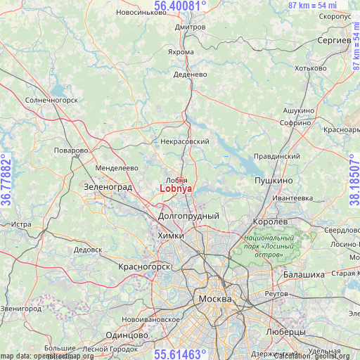
Lobnya GPS coordinates[2]
56° 0' 34.992" North, 37° 28' 54.984" East
| Map corner | latitude | longitude |
|---|---|---|
| Upper-left | 56.40081°, | 36.77882° |
| Center: | 56.00972°, | 37.48194° |
| Lower-right: | 55.61463°, | 38.18507° |
| Map W x H: | 87.4×87.4 km | = 54.3×54.3mi |
| max Lat: | 73.50819° ⇑33.3% North |
| Lobnya: | 56.00972° |
| min Lat: | ⇓66.7% South 41.28413° |
| min Long | Lobnya | max Long |
| -179.12198° | 37.48194° | 179.35046° |
| W 17.8%⇐ | ⇒82.2% E |
Elevation
Elevation of Lobnya is 192 m = 630 ft, and this is 10.6 m = 35 ft below average elevation for this country.
| Max E: |
2518 m = 8261 ft | 31.6% |
| Avg. | 202.6 m = 665 ft | |
| Lobnya | 192 m = 630 ft | |
Min E: |
-28 m = -92 ft | 68.4% |
See also: Lobnya elevation on elevation.city.
Geographical zone
Lobnya is located in North temperate zone (between Tropic of Cancer and the Arctic Circle). Distance of this North polar circle is 1173.5 km =729.2 mi to North.| Distance of | km | miles | from Lobnya |
|---|---|---|---|
| North Pole | 3779.4 | 2348.4 | to North |
| Arctic Circle | 1173.5 | 729.2 | to North |
| Tropic Cancer | 3621.8 | 2250.5 | to South |
| Equator | 6227.7 | 3869.7 | to South |


Nearby cities:
15 places around Lobnya: (largest is in red/bold)
• Belyaninovo
13.7 km =8.5 mi,  124°
124°
• Dolgoprudnyy
6.8 km =4.2 mi,  169°
169°
• Khimki
12.9 km =8 mi,  194°
194°
• Lianozovo
14 km =8.7 mi,  152°
152°
• Lugovaya
4.5 km =2.8 mi,  1°
1°
• Marfino
8.5 km =5.3 mi,  34°
34°
• Nekrasovskiy
9.4 km =5.8 mi,  6°
6°
• Novopodrezkovo
11.6 km =7.2 mi,  227°
227°
• Poselok Turisticheskogo pansionata "Klyazminskoe vodohranilische"
11.9 km =7.4 mi,  97°
97°
• Povedniki
8.6 km =5.3 mi, 121°
• Severnyy
9.2 km =5.7 mi, 153°
• Sheremet’yevskiy
3.8 km =2.4 mi, 168°
• Skhodnya
13.4 km =8.3 mi,  239°
239°
• Vagonoremont
12.9 km =8 mi,  160°
160°
• Zhostovo
10.5 km =6.5 mi,  85°
85°
Sources, notices
• [Note1] Compared only with cities in Russia existing in our database
• [Src1] Map data: © OpenStreetMap contributors (CC-BY-SA)
• [Src2] Other city data from geonames.org with taken over terms of usage.
• [Src3] Geographical zone / Annual Mean Temperature by Robert A. Rohde @ Wikipedia
