Lugovaya geodata
Lugovaya (Moscow Oblast) is a populated place; located in Russia in Europe/Moscow (GMT+3) time zone. With population of 3,086 people, there are 3705 cities with bigger population in this country. Compared to other cities in Russia, 67.3% of cities are located further ↓South; 82.1% of cities are located further →East and 72.6% of cities have lower elevation than Lugovaya. Note1


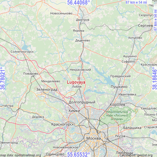
Lugovaya GPS coordinates[2]
56° 3' 0" North, 37° 28' 59.988" East
| Map corner | latitude | longitude |
|---|---|---|
| Upper-left | 56.44068°, | 36.78021° |
| Center: | 56.05°, | 37.48333° |
| Lower-right: | 55.65532°, | 38.18646° |
| Map W x H: | 87.3×87.3 km | = 54.2×54.2mi |
| max Lat: | 73.50819° ⇑32.7% North |
| Lugovaya: | 56.05° |
| min Lat: | ⇓67.3% South 41.28413° |
| min Long | Lugovaya | max Long |
| -179.12198° | 37.48333° | 179.35046° |
| W 17.9%⇐ | ⇒82.1% E |
Elevation
Elevation of Lugovaya is 207 m = 679 ft, and this is 4.4 m = 14 ft above average elevation for this country.
| Max E: |
2518 m = 8261 ft | 27.4% |
| Lugovaya | 207 m 679 ft | |
| Avg. | 202.6 m = 665 ft | |
Min E: |
-28 m = -92 ft | 72.6% |
See also: Russia elevation on elevation.city.
Geographical zone
Lugovaya is located in North temperate zone (between Tropic of Cancer and the Arctic Circle). Distance of this North polar circle is 1169 km =726.4 mi to North.| Distance of | km | miles | from Lugovaya |
|---|---|---|---|
| North Pole | 3774.9 | 2345.6 | to North |
| Arctic Circle | 1169 | 726.4 | to North |
| Tropic Cancer | 3626.3 | 2253.3 | to South |
| Equator | 6232.2 | 3872.5 | to South |


Nearby cities:
15 places around Lugovaya: (largest is in red/bold)
• Dolgoprudnyy
11.2 km =7 mi,  174°
174°
• Ignatovo
13.9 km =8.6 mi,  14°
14°
• Iksha
13.6 km =8.5 mi,  3°
3°
• Lobnya
4.5 km =2.8 mi,  181°
181°
• Marfino
5.3 km =3.3 mi,  62°
62°
• Nekrasovskiy
4.9 km =3 mi, 11°
• Novopodrezkovo
15 km =9.3 mi,  215°
215°
• Poselok Turisticheskogo pansionata "Klyazminskoe vodohranilische"
13.2 km =8.2 mi,  117°
117°
• Povedniki
11.5 km =7.1 mi,  140°
140°
• Rzhavki
15.5 km =9.6 mi,  249°
249°
• Severnyy
13.3 km =8.3 mi,  162°
162°
• Sheremet’yevskiy
8.3 km =5.2 mi, 175°
• Skhodnya
16.2 km =10.1 mi,  225°
225°
• Yermolino
11 km =6.8 mi, 2°
• Zhostovo
11 km =6.8 mi,  109°
109°
Sources, notices
• [Note1] Compared only with cities in Russia existing in our database
• [Src1] Map data: © OpenStreetMap contributors (CC-BY-SA)
• [Src2] Other city data from geonames.org with taken over terms of usage.
• [Src3] Geographical zone / Annual Mean Temperature by Robert A. Rohde @ Wikipedia
