Kuz’minskoye geodata
Kuz’minskoye (Ryazan Oblast) is a populated place; located in Russia in Europe/Moscow (GMT+3) time zone. With population of 513 people, there are 4957 cities with bigger population in this country. Compared to other cities in Russia, 51.8% of cities are located further ↓South; 69.3% of cities are located further →East and 51.1% of cities have lower elevation than Kuz’minskoye. Note1


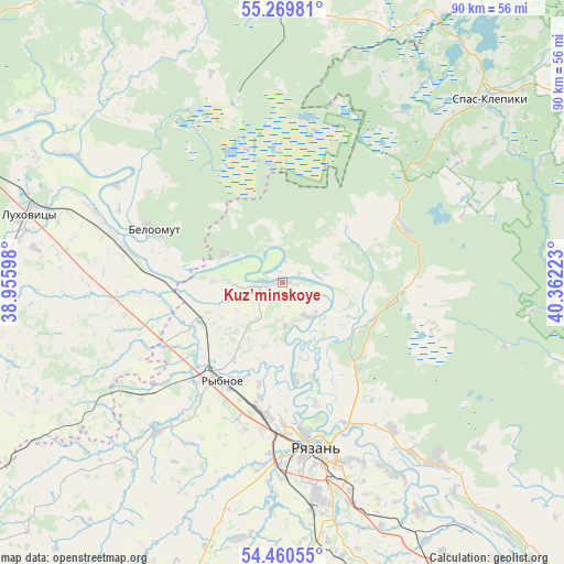
Kuz’minskoye GPS coordinates[2]
54° 52' 1.956" North, 39° 39' 32.76" East
| Map corner | latitude | longitude |
|---|---|---|
| Upper-left | 55.26981°, | 38.95598° |
| Center: | 54.86721°, | 39.6591° |
| Lower-right: | 54.46055°, | 40.36223° |
| Map W x H: | 90×90 km | = 55.9×55.9mi |
| max Lat: | 73.50819° ⇑48.2% North |
| Kuz’minskoye: | 54.86721° |
| min Lat: | ⇓51.8% South 41.28413° |
| min Long | Kuz’minskoye | max Long |
| -179.12198° | 39.6591° | 179.35046° |
| W 30.7%⇐ | ⇒69.3% E |
Elevation
Elevation of Kuz’minskoye is 147 m = 482 ft, and this is 55.6 m = 182 ft below average elevation for this country.
| Max E: |
2518 m = 8261 ft | 48.9% |
| Avg. | 202.6 m = 665 ft | |
| Kuz’minskoye | 147 m = 482 ft | |
Min E: |
-28 m = -92 ft | 51.1% |
See also: Russia elevation on elevation.city.
Geographical zone
Kuz’minskoye is located in North temperate zone (between Tropic of Cancer and the Arctic Circle). Distance of this North polar circle is 1300.5 km =808.1 mi to North.| Distance of | km | miles | from Kuz’minskoye |
|---|---|---|---|
| North Pole | 3906.4 | 2427.3 | to North |
| Arctic Circle | 1300.5 | 808.1 | to North |
| Tropic Cancer | 3494.7 | 2171.5 | to South |
| Equator | 6100.7 | 3790.8 | to South |


Nearby cities:
15 places around Kuz’minskoye: (largest is in red/bold)
• Bagramovo
20.8 km =12.9 mi,  219°
219°
• Beloomut
22.2 km =13.8 mi,  292°
292°
• Dmitrovskiy Pogost
50.8 km =31.6 mi,  12°
12°
• Krasnaya Poyma
39.9 km =24.8 mi, 291°
• Lukhovitsy
41.1 km =25.5 mi, 287°
• Murmino
38.7 km =24 mi,  139°
139°
• Polyany
19.9 km =12.4 mi,  146°
146°
• Radovitskiy
30.3 km =18.8 mi,  16°
16°
• Ryazan’
26.8 km =16.7 mi,  175°
175°
• Rybnoye
18 km =11.2 mi,  210°
210°
• Sel’nikovo
43.7 km =27.2 mi,  313°
313°
• Solotcha
14.1 km =8.8 mi,  127°
127°
• Spas-Klepiki
44.4 km =27.6 mi,  47°
47°
• Yurtsovo
58.1 km =36.1 mi,  329°
329°
• Zaraysk
51.4 km =31.9 mi,  256°
256°
Sources, notices
• [Note1] Compared only with cities in Russia existing in our database
• [Src1] Map data: © OpenStreetMap contributors (CC-BY-SA)
• [Src2] Other city data from geonames.org with taken over terms of usage.
• [Src3] Geographical zone / Annual Mean Temperature by Robert A. Rohde @ Wikipedia
