Spas-Klepiki geodata
Spas-Klepiki (Ryazan Oblast) is a populated place; located in Russia in Europe/Moscow (GMT+3) time zone. With population of 5,942 people, there are 2276 cities with bigger population in this country. Compared to other cities in Russia, 54.7% of cities are located further ↓South; 66.7% of cities are located further →East and 63.5% of cities have higher elevation than Spas-Klepiki. Note1


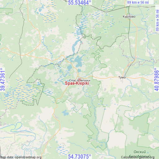
Spas-Klepiki GPS coordinates[2]
55° 8' 4.992" North, 40° 10' 36.228" East
| Map corner | latitude | longitude |
|---|---|---|
| Upper-left | 55.53464°, | 39.47361° |
| Center: | 55.13472°, | 40.17673° |
| Lower-right: | 54.73075°, | 40.87986° |
| Map W x H: | 89.4×89.4 km | = 55.6×55.6mi |
| max Lat: | 73.50819° ⇑45.3% North |
| Spas-Klepiki: | 55.13472° |
| min Lat: | ⇓54.7% South 41.28413° |
| min Long | Spas-Klepiki | max Long |
| -179.12198° | 40.17673° | 179.35046° |
| W 33.3%⇐ | ⇒66.7% E |
Elevation
Elevation of Spas-Klepiki is 117 m = 384 ft, and this is 85.6 m = 281 ft below average elevation for this country.
| Max E: |
2518 m = 8261 ft | 63.5% |
| Avg. | 202.6 m = 665 ft | |
| Spas-Klepiki | 117 m = 384 ft | |
Min E: |
-28 m = -92 ft | 36.5% |
See also: Russia elevation on elevation.city.
Geographical zone
Spas-Klepiki is located in North temperate zone (between Tropic of Cancer and the Arctic Circle). Distance of this North polar circle is 1270.8 km =789.6 mi to North.| Distance of | km | miles | from Spas-Klepiki |
|---|---|---|---|
| North Pole | 3876.7 | 2408.9 | to North |
| Arctic Circle | 1270.8 | 789.6 | to North |
| Tropic Cancer | 3524.5 | 2190 | to South |
| Equator | 6130.4 | 3809.3 | to South |


Nearby cities:
15 places around Spas-Klepiki: (largest is in red/bold)
• Beloomut
57.4 km =35.7 mi,  248°
248°
• Cherusti
47.3 km =29.4 mi,  347°
347°
• Dmitrovskiy Pogost
29.5 km =18.3 mi,  312°
312°
• Erleks
53.6 km =33.3 mi,  14°
14°
• Kurlovo
38.5 km =23.9 mi,  30°
30°
• Kuz’minskoye
44.4 km =27.6 mi,  227°
227°
• Mezinovskiy
42.7 km =26.5 mi,  15°
15°
• Murmino
59.5 km =37 mi,  187°
187°
• Polyany
51.4 km =31.9 mi,  205°
205°
• Radovitskiy
24.2 km =15 mi,  268°
268°
• Savinskaya
28.7 km =17.8 mi,  335°
335°
• Solotcha
44.2 km =27.5 mi, 209°
• Tugolesskiy Bor
51.3 km =31.9 mi,  334°
334°
• Tuma
24 km =14.9 mi,  86°
86°
• Velikodvorskiy
33.7 km =20.9 mi,  67°
67°
Sources, notices
• [Note1] Compared only with cities in Russia existing in our database
• [Src1] Map data: © OpenStreetMap contributors (CC-BY-SA)
• [Src2] Other city data from geonames.org with taken over terms of usage.
• [Src3] Geographical zone / Annual Mean Temperature by Robert A. Rohde @ Wikipedia
