Kichmengskiy Gorodok geodata
Kichmengskiy Gorodok (Vologda) is a populated place; located in Russia in Europe/Moscow (GMT+3) time zone. With population of 6,623 people, there are 2094 cities with bigger population in this country. Compared to other cities in Russia, 90.1% of cities are located further ↓South; 52.3% of cities are located further ←West and 68.2% of cities have higher elevation than Kichmengskiy Gorodok. Note1


Kichmengskiy Gorodok GPS coordinates[2]
59° 58' 53.904" North, 45° 47' 7.548" East
| Map corner | latitude | longitude |
|---|---|---|
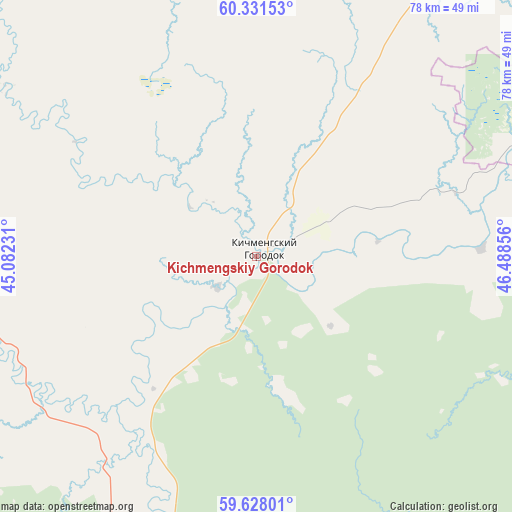
| Upper-left | 60.33153°, | 45.08231° |
| Center: | 59.98164°, | 45.78543° |
| Lower-right: | 59.62801°, | 46.48856° |
| Map W x H: | 78.2×78.2 km | = 48.6×48.6mi |
| max Lat: | 73.50819° ⇑9.9% North |
| Kichmengskiy Gorodok: | 59.98164° |
| min Lat: | ⇓90.1% South 41.28413° |
| min Long | Kichmengskiy Go | max Long |
| -179.12198° | 45.78543° | 179.35046° |
| W 52.3%⇐ | ⇒47.7% E |
Elevation
Elevation of Kichmengskiy Gorodok is 107 m = 351 ft, and this is 95.6 m = 314 ft below average elevation for this country.
| Max E: |
2518 m = 8261 ft | 68.2% |
| Avg. | 202.6 m = 665 ft | |
| Kichmengskiy Gorodok | 107 m = 351 ft | |
Min E: |
-28 m = -92 ft | 31.8% |
See also: Russia elevation on elevation.city.
Geographical zone
Kichmengskiy Gorodok is located in North temperate zone (between Tropic of Cancer and the Arctic Circle). Distance of this North polar circle is 731.8 km =454.7 mi to North.| Distance of | km | miles | from Kichmengskiy Gorodok |
|---|---|---|---|
| North Pole | 3337.7 | 2073.9 | to North |
| Arctic Circle | 731.8 | 454.7 | to North |
| Tropic Cancer | 4063.4 | 2524.9 | to South |
| Equator | 6669.3 | 4144.1 | to South |


Nearby cities:
15 places around Kichmengskiy Gorodok: (largest is in red/bold)
• Dem’yanovo
82.8 km =51.4 mi,  60°
60°
• Khristoforovo
129.9 km =80.7 mi,  38°
38°
• Krasavino
115.5 km =71.8 mi,  19°
19°
• Luza
108.3 km =67.3 mi,  48°
48°
• Maromitsa
124.7 km =77.5 mi,  95°
95°
• Nikol’sk
52.9 km =32.9 mi,  200°
200°
• Nyuksenitsa
98.2 km =61 mi,  299°
299°
• Pavino
98.5 km =61.2 mi,  168°
168°
• Pinyug
114.7 km =71.3 mi,  74°
74°
• Podosinovets
78.2 km =48.6 mi, 65°
• Privodino
127.8 km =79.4 mi, 17°
• Pyshchug
121.8 km =75.7 mi,  181°
181°
• Udimskiy
129.2 km =80.3 mi,  3°
3°
• Velikiy Ustyug
91.5 km =56.9 mi, 18°
• Vokhma
129.2 km =80.3 mi,  154°
154°
Sources, notices
• [Note1] Compared only with cities in Russia existing in our database
• [Src1] Map data: © OpenStreetMap contributors (CC-BY-SA)
• [Src2] Other city data from geonames.org with taken over terms of usage.
• [Src3] Geographical zone / Annual Mean Temperature by Robert A. Rohde @ Wikipedia
