Karintorf geodata
Karintorf (Kirov) is a populated place; located in Russia in Europe/Kirov (GMT+3) time zone. With population of 1,000 people, there are 4627 cities with bigger population in this country. Compared to other cities in Russia, 85.1% of cities are located further ↓South; 62.3% of cities are located further ←West and 62.5% of cities have higher elevation than Karintorf. Note1


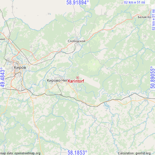
Karintorf GPS coordinates[2]
58° 33' 14.544" North, 50° 11' 14.712" East
| Map corner | latitude | longitude |
|---|---|---|
| Upper-left | 58.91894°, | 49.4843° |
| Center: | 58.55404°, | 50.18742° |
| Lower-right: | 58.1853°, | 50.89055° |
| Map W x H: | 81.6×81.6 km | = 50.7×50.7mi |
| max Lat: | 73.50819° ⇑14.9% North |
| Karintorf: | 58.55404° |
| min Lat: | ⇓85.1% South 41.28413° |
| min Long | Karintorf | max Long |
| -179.12198° | 50.18742° | 179.35046° |
| W 62.3%⇐ | ⇒37.7% E |
Elevation
Elevation of Karintorf is 119 m = 390 ft, and this is 83.6 m = 274 ft below average elevation for this country.
| Max E: |
2518 m = 8261 ft | 62.5% |
| Avg. | 202.6 m = 665 ft | |
| Karintorf | 119 m = 390 ft | |
Min E: |
-28 m = -92 ft | 37.5% |
See also: Russia elevation on elevation.city.
Geographical zone
Karintorf is located in North temperate zone (between Tropic of Cancer and the Arctic Circle). Distance of this North polar circle is 890.6 km =553.4 mi to North.| Distance of | km | miles | from Karintorf |
|---|---|---|---|
| North Pole | 3496.5 | 2172.6 | to North |
| Arctic Circle | 890.6 | 553.4 | to North |
| Tropic Cancer | 3904.7 | 2426.3 | to South |
| Equator | 6510.6 | 4045.5 | to South |


Nearby cities:
15 places around Karintorf: (largest is in red/bold)
• Belaya Kholunitsa
49.9 km =31 mi,  50°
50°
• Bystritsa
56.4 km =35 mi,  267°
267°
• Kirov
30.9 km =19.2 mi,  278°
278°
• Kirovo-Chepetsk
8.6 km =5.3 mi, 269°
• Kumëny
52 km =32.3 mi,  197°
197°
• Lyangasovo
43.2 km =26.8 mi,  264°
264°
• Murygino
46.9 km =29.1 mi,  295°
295°
• Nizhneivkino
55.8 km =34.7 mi,  224°
224°
• Pasegovo
39.5 km =24.5 mi, 262°
• Raduzhnyy
32.2 km =20 mi, 259°
• Slobodskoy
19.8 km =12.3 mi,  358°
358°
• Strizhi
53.4 km =33.2 mi, 258°
• Stulovo
18.9 km =11.7 mi,  352°
352°
• Vakhrushi
17.3 km =10.7 mi,  327°
327°
• Zuyevka
57.4 km =35.7 mi,  106°
106°
Sources, notices
• [Note1] Compared only with cities in Russia existing in our database
• [Src1] Map data: © OpenStreetMap contributors (CC-BY-SA)
• [Src2] Other city data from geonames.org with taken over terms of usage.
• [Src3] Geographical zone / Annual Mean Temperature by Robert A. Rohde @ Wikipedia
