Belaya Kholunitsa geodata
Belaya Kholunitsa (Kirov) is a populated place; located in Russia in Europe/Kirov (GMT+3) time zone. With population of 11,658 people, there are 1309 cities with bigger population in this country. Compared to other cities in Russia, 86.1% of cities are located further ↓South; 62.9% of cities are located further ←West and 50.2% of cities have higher elevation than Belaya Kholunitsa. Note1


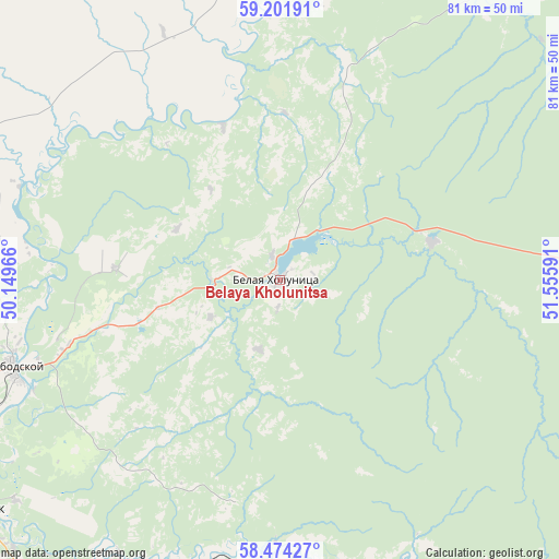
Belaya Kholunitsa GPS coordinates[2]
58° 50' 24" North, 50° 51' 10.008" East
| Map corner | latitude | longitude |
|---|---|---|
| Upper-left | 59.20191°, | 50.14966° |
| Center: | 58.84°, | 50.85278° |
| Lower-right: | 58.47427°, | 51.55591° |
| Map W x H: | 80.9×80.9 km | = 50.3×50.3mi |
| max Lat: | 73.50819° ⇑13.9% North |
| Belaya Kholunitsa: | 58.84° |
| min Lat: | ⇓86.1% South 41.28413° |
| min Long | Belaya Kholunit | max Long |
| -179.12198° | 50.85278° | 179.35046° |
| W 62.9%⇐ | ⇒37.1% E |
Elevation
Elevation of Belaya Kholunitsa is 144 m = 472 ft, and this is 58.6 m = 192 ft below average elevation for this country.
| Max E: |
2518 m = 8261 ft | 50.2% |
| Avg. | 202.6 m = 665 ft | |
| Belaya Kholunitsa | 144 m = 472 ft | |
Min E: |
-28 m = -92 ft | 49.8% |
See also: Russia elevation on elevation.city.
Geographical zone
Belaya Kholunitsa is located in North temperate zone (between Tropic of Cancer and the Arctic Circle). Distance of this North polar circle is 858.8 km =533.6 mi to North.| Distance of | km | miles | from Belaya Kholunitsa |
|---|---|---|---|
| North Pole | 3464.7 | 2152.9 | to North |
| Arctic Circle | 858.8 | 533.6 | to North |
| Tropic Cancer | 3936.5 | 2446 | to South |
| Equator | 6542.4 | 4065.3 | to South |


Nearby cities:
15 places around Belaya Kholunitsa: (largest is in red/bold)
• Chërnaya Kholunitsa
49.6 km =30.8 mi,  88°
88°
• Dubrovka
46.6 km =29 mi,  21°
21°
• Falënki
68.4 km =42.5 mi,  141°
141°
• Karintorf
49.9 km =31 mi,  230°
230°
• Kirov
74 km =46 mi,  248°
248°
• Kirovo-Chepetsk
56.7 km =35.2 mi,  235°
235°
• Kosino
53.5 km =33.2 mi,  152°
152°
• Nagorsk
53.1 km =33 mi,  357°
357°
• Omutninsk
79.6 km =49.5 mi,  103°
103°
• Raduzhnyy
79.5 km =49.4 mi, 241°
• Slobodskoy
40.7 km =25.3 mi, 252°
• Stulovo
42.9 km =26.7 mi, 252°
• Vakhrushi
50.7 km =31.5 mi, 250°
• Vostochnyy
80.4 km =50 mi, 94°
• Zuyevka
51 km =31.7 mi,  161°
161°
In other languages:
- In France: Belaïa Kholounitsa
- In German: Belaja Choluniza
- In Italian: Belaja Cholunica
- In Russian: Белая Холуница
- In Chinese: 白霍盧尼察
Sources, notices
• [Note1] Compared only with cities in Russia existing in our database
• [Src1] Map data: © OpenStreetMap contributors (CC-BY-SA)
• [Src2] Other city data from geonames.org with taken over terms of usage.
• [Src3] Geographical zone / Annual Mean Temperature by Robert A. Rohde @ Wikipedia
