Kamenka geodata
Kamenka (Kabardino-Balkariya Republic) is a populated place; located in Russia in Europe/Moscow (GMT+3) time zone. With population of 3,525 people, there are 3384 cities with bigger population in this country. Compared to other cities in Russia, 93.8% of cities are located further ↑North; 54.6% of cities are located further →East and 93.5% of cities have lower elevation than Kamenka. Note1


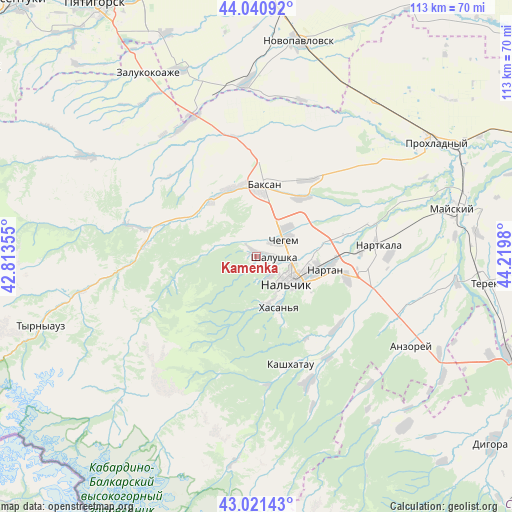
Kamenka GPS coordinates[2]
43° 31' 59.988" North, 43° 31' 0.012" East
| Map corner | latitude | longitude |
|---|---|---|
| Upper-left | 44.04092°, | 42.81355° |
| Center: | 43.53333°, | 43.51667° |
| Lower-right: | 43.02143°, | 44.2198° |
| Map W x H: | 113.4×113.4 km | = 70.5×70.5mi |
| max Lat: | 73.50819° ⇑93.8% North |
| Kamenka: | 43.53333° |
| min Lat: | ⇓6.2% South 41.28413° |
| min Long | Kamenka | max Long |
| -179.12198° | 43.51667° | 179.35046° |
| W 45.4%⇐ | ⇒54.6% E |
Elevation
Elevation of Kamenka is 555 m = 1821 ft, and this is 352.4 m = 1156 ft above average elevation for this country.
| Max E: |
2518 m = 8261 ft | 6.5% |
| Kamenka | 555 m 1821 ft | |
| Avg. | 202.6 m = 665 ft | |
Min E: |
-28 m = -92 ft | 93.5% |
See also: Russia elevation on elevation.city.
Geographical zone
Kamenka is located in North temperate zone (between Tropic of Cancer and the Arctic Circle). Distance of this Northern Tropic circle is 2234.5 km =1388.5 mi to South.| Distance of | km | miles | from Kamenka |
|---|---|---|---|
| North Pole | 5166.6 | 3210.4 | to North |
| Arctic Circle | 2560.7 | 1591.1 | to North |
| Tropic Cancer | 2234.5 | 1388.5 | to South |
| Equator | 4840.5 | 3007.7 | to South |


Nearby cities:
15 places around Kamenka: (largest is in red/bold)
• Aleksandrovskaya
12.1 km =7.5 mi,  117°
117°
• Baksan
17.3 km =10.7 mi,  5°
5°
• Belaya Rechka
10.7 km =6.6 mi,  172°
172°
• Chegem Vtoroy
9.6 km =6 mi,  43°
43°
• Dugulubgey
14.5 km =9 mi, 6°
• Islamey
16.6 km =10.3 mi,  342°
342°
• Kenzhe
4.8 km =3 mi,  137°
137°
• Kishpek
16.8 km =10.4 mi, 36°
• Kyzburun Pervyy
16.4 km =10.2 mi,  323°
323°
• Lechinkay
7.6 km =4.7 mi,  297°
297°
• Nal’chik
9.1 km =5.7 mi, 115°
• Nartan
14.9 km =9.3 mi,  99°
99°
• Shalushka
4 km =2.5 mi,  91°
91°
• Vol’nyy Aul
10.8 km =6.7 mi, 124°
• Zayukovo
17.4 km =10.8 mi, 302°
Sources, notices
• [Note1] Compared only with cities in Russia existing in our database
• [Src1] Map data: © OpenStreetMap contributors (CC-BY-SA)
• [Src2] Other city data from geonames.org with taken over terms of usage.
• [Src3] Geographical zone / Annual Mean Temperature by Robert A. Rohde @ Wikipedia
