Kaluga geodata
Kaluga is a seat of a first-order administrative division; located in Russia in Europe/Moscow (GMT+3) time zone. With population of 338,978 people, there are 53 cities with bigger population in this country. Compared to other cities in Russia, 50.9% of cities are located further ↑North; 86.8% of cities are located further →East and 70.8% of cities have lower elevation than Kaluga. Note1


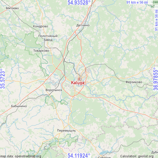
Kaluga GPS coordinates[2]
54° 31' 45.48" North, 36° 16' 31.512" East
| Map corner | latitude | longitude |
|---|---|---|
| Upper-left | 54.93528°, | 35.5723° |
| Center: | 54.5293°, | 36.27542° |
| Lower-right: | 54.11924°, | 36.97855° |
| Map W x H: | 90.7×90.7 km | = 56.4×56.4mi |
| max Lat: | 73.50819° ⇑50.9% North |
| Kaluga: | 54.5293° |
| min Lat: | ⇓49.1% South 41.28413° |
| min Long | Kaluga | max Long |
| -179.12198° | 36.27542° | 179.35046° |
| W 13.2%⇐ | ⇒86.8% E |
Elevation
Elevation of Kaluga is 200 m = 656 ft, and this is 2.6 m = 9 ft below average elevation for this country.
| Max E: |
2518 m = 8261 ft | 29.2% |
| Avg. | 202.6 m = 665 ft | |
| Kaluga | 200 m = 656 ft | |
Min E: |
-28 m = -92 ft | 70.8% |
See also: Kaluga elevation on elevation.city.
Geographical zone
Kaluga is located in North temperate zone (between Tropic of Cancer and the Arctic Circle). Distance of this North polar circle is 1338.1 km =831.5 mi to North.| Distance of | km | miles | from Kaluga |
|---|---|---|---|
| North Pole | 3944 | 2450.7 | to North |
| Arctic Circle | 1338.1 | 831.5 | to North |
| Tropic Cancer | 3457.2 | 2148.2 | to South |
| Equator | 6063.1 | 3767.4 | to South |


Nearby cities:
15 places around Kaluga: (largest is in red/bold)
• Avchurino
12.8 km =8 mi,  129°
129°
• Babynino
36 km =22.4 mi,  245°
245°
• Detchino
31.2 km =19.4 mi,  3°
3°
• Dugna
39.6 km =24.6 mi,  109°
109°
• Dvortsy
20.4 km =12.7 mi,  298°
298°
• Ferzikovo
31.1 km =19.3 mi,  92°
92°
• Kondrovo
38.1 km =23.7 mi,  324°
324°
• Kurovskoye
17.7 km =11 mi,  274°
274°
• Mstikhino
10.1 km =6.3 mi,  289°
289°
• Peremyshl’
30.5 km =19 mi,  194°
194°
• Polotnyanyy Zavod
29.2 km =18.1 mi, 317°
• Pyatovskiy
22.7 km =14.1 mi, 321°
• Tovarkovo
27.2 km =16.9 mi,  306°
306°
• Vorotynsk
18.6 km =11.6 mi,  232°
232°
• Zhiletovo
24.4 km =15.2 mi, 318°
Sources, notices
• [Note1] Compared only with cities in Russia existing in our database
• [Src1] Map data: © OpenStreetMap contributors (CC-BY-SA)
• [Src2] Other city data from geonames.org with taken over terms of usage.
• [Src3] Geographical zone / Annual Mean Temperature by Robert A. Rohde @ Wikipedia
