Kalnibolotskaya geodata
Kalnibolotskaya (Krasnodarskiy) is a populated place; located in Russia in Europe/Moscow (GMT+3) time zone. With population of 6,578 people, there are 2106 cities with bigger population in this country. Compared to other cities in Russia, 84.1% of cities are located further ↑North; 65.3% of cities are located further →East and 85.1% of cities have higher elevation than Kalnibolotskaya. Note1


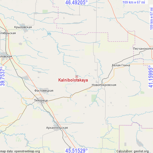
Kalnibolotskaya GPS coordinates[2]
46° 0' 20.988" North, 40° 27' 24.552" East
| Map corner | latitude | longitude |
|---|---|---|
| Upper-left | 46.49205°, | 39.7537° |
| Center: | 46.00583°, | 40.45682° |
| Lower-right: | 45.51529°, | 41.15995° |
| Map W x H: | 108.6×108.6 km | = 67.5×67.5mi |
| max Lat: | 73.50819° ⇑84.1% North |
| Kalnibolotskaya: | 46.00583° |
| min Lat: | ⇓15.9% South 41.28413° |
| min Long | Kalnibolotskaya | max Long |
| -179.12198° | 40.45682° | 179.35046° |
| W 34.7%⇐ | ⇒65.3% E |
Elevation
Elevation of Kalnibolotskaya is 47 m = 154 ft, and this is 155.6 m = 510 ft below average elevation for this country.
| Max E: |
2518 m = 8261 ft | 85.1% |
| Avg. | 202.6 m = 665 ft | |
| Kalnibolotskaya | 47 m = 154 ft | |
Min E: |
-28 m = -92 ft | 14.9% |
See also: Russia elevation on elevation.city.
Geographical zone
Kalnibolotskaya is located in North temperate zone (between Tropic of Cancer and the Arctic Circle). Distance of this North polar circle is 2285.8 km =1420.3 mi to North.| Distance of | km | miles | from Kalnibolotskaya |
|---|---|---|---|
| North Pole | 4891.7 | 3039.6 | to North |
| Arctic Circle | 2285.8 | 1420.3 | to North |
| Tropic Cancer | 2509.4 | 1559.3 | to South |
| Equator | 5115.4 | 3178.6 | to South |


Nearby cities:
15 places around Kalnibolotskaya: (largest is in red/bold)
• Alekseyevskaya
35 km =21.7 mi,  221°
221°
• Belaya Glina
32.6 km =20.3 mi,  75°
75°
• Dmitriyevskaya
45.6 km =28.3 mi,  148°
148°
• Fastovetskaya
25 km =15.5 mi,  247°
247°
• Krylovskaya
51.1 km =31.8 mi,  312°
312°
• Kubanskiy
12.8 km =8 mi,  131°
131°
• Lenina
52.4 km =32.6 mi,  277°
277°
• Mirskoy
51.6 km =32.1 mi,  184°
184°
• Novoleushkovskaya
35.9 km =22.3 mi,  268°
268°
• Novopokrovskaya
19.8 km =12.3 mi,  107°
107°
• Novorozhdestvenskaya
42.4 km =26.3 mi, 247°
• Parkovyy
30.8 km =19.1 mi,  231°
231°
• Peschanokopskoye
52.6 km =32.7 mi,  66°
66°
• Ternevskaya
17.5 km =10.9 mi,  191°
191°
• Tikhoretsk
30.7 km =19.1 mi,  236°
236°
Sources, notices
• [Note1] Compared only with cities in Russia existing in our database
• [Src1] Map data: © OpenStreetMap contributors (CC-BY-SA)
• [Src2] Other city data from geonames.org with taken over terms of usage.
• [Src3] Geographical zone / Annual Mean Temperature by Robert A. Rohde @ Wikipedia
