Peschanokopskoye geodata
Peschanokopskoye (Rostov) is a seat of a second-order administrative division; located in Russia in Europe/Moscow (GMT+3) time zone. With population of 11,340 people, there are 1337 cities with bigger population in this country. Compared to other cities in Russia, 83.7% of cities are located further ↑North; 62.8% of cities are located further →East and 78.4% of cities have higher elevation than Peschanokopskoye. Note1


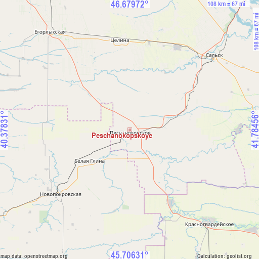
Peschanokopskoye GPS coordinates[2]
46° 11' 42.612" North, 41° 4' 53.148" East
| Map corner | latitude | longitude |
|---|---|---|
| Upper-left | 46.67972°, | 40.37831° |
| Center: | 46.19517°, | 41.08143° |
| Lower-right: | 45.70631°, | 41.78456° |
| Map W x H: | 108.2×108.2 km | = 67.2×67.2mi |
| max Lat: | 73.50819° ⇑83.7% North |
| Peschanokopskoye: | 46.19517° |
| min Lat: | ⇓16.3% South 41.28413° |
| min Long | Peschanokopskoy | max Long |
| -179.12198° | 41.08143° | 179.35046° |
| W 37.2%⇐ | ⇒62.8% E |
Elevation
Elevation of Peschanokopskoye is 76 m = 249 ft, and this is 126.6 m = 415 ft below average elevation for this country.
| Max E: |
2518 m = 8261 ft | 78.4% |
| Avg. | 202.6 m = 665 ft | |
| Peschanokopskoye | 76 m = 249 ft | |
Min E: |
-28 m = -92 ft | 21.6% |
See also: Russia elevation on elevation.city.
Geographical zone
Peschanokopskoye is located in North temperate zone (between Tropic of Cancer and the Arctic Circle). Distance of this North polar circle is 2264.8 km =1407.3 mi to North.| Distance of | km | miles | from Peschanokopskoye |
|---|---|---|---|
| North Pole | 4870.6 | 3026.4 | to North |
| Arctic Circle | 2264.8 | 1407.3 | to North |
| Tropic Cancer | 2530.5 | 1572.4 | to South |
| Equator | 5136.4 | 3191.6 | to South |


Nearby cities:
15 places around Peschanokopskoye: (largest is in red/bold)
• Belaya Glina
21.1 km =13.1 mi,  231°
231°
• Gigant
40 km =24.9 mi,  29°
29°
• Kalnibolotskaya
52.6 km =32.7 mi,  246°
246°
• Krasnaya Polyana
33.6 km =20.9 mi,  105°
105°
• Krasnogvardeyskoye
51.5 km =32 mi,  138°
138°
• Kubanskiy
48.7 km =30.3 mi, 232°
• Letnik
24.9 km =15.5 mi,  145°
145°
• Novopokrovskaya
40 km =24.9 mi, 227°
• Novyy Yegorlyk
64.6 km =40.1 mi,  70°
70°
• Sal’sk
47 km =29.2 mi,  48°
48°
• Sandata
52.7 km =32.7 mi,  80°
80°
• Ternevskaya
64.3 km =40 mi, 233°
• Tselina
37.8 km =23.5 mi,  354°
354°
• Uspenskaya
47.9 km =29.8 mi,  181°
181°
• Yegorlykskaya
52.5 km =32.6 mi,  321°
321°
Sources, notices
• [Note1] Compared only with cities in Russia existing in our database
• [Src1] Map data: © OpenStreetMap contributors (CC-BY-SA)
• [Src2] Other city data from geonames.org with taken over terms of usage.
• [Src3] Geographical zone / Annual Mean Temperature by Robert A. Rohde @ Wikipedia
