Germenchik geodata
Germenchik (Kabardino-Balkariya Republic) is a populated place; located in Russia in Europe/Moscow (GMT+3) time zone. With population of 4,129 people, there are 3041 cities with bigger population in this country. Compared to other cities in Russia, 93.6% of cities are located further ↑North; 53.6% of cities are located further →East and 83.8% of cities have lower elevation than Germenchik. Note1


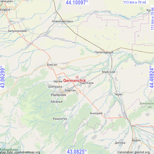
Germenchik GPS coordinates[2]
43° 35' 38.004" North, 43° 45' 57.996" East
| Map corner | latitude | longitude |
|---|---|---|
| Upper-left | 44.10097°, | 43.06299° |
| Center: | 43.59389°, | 43.76611° |
| Lower-right: | 43.0825°, | 44.46924° |
| Map W x H: | 113.2×113.2 km | = 70.3×70.3mi |
| max Lat: | 73.50819° ⇑93.6% North |
| Germenchik: | 43.59389° |
| min Lat: | ⇓6.4% South 41.28413° |
| min Long | Germenchik | max Long |
| -179.12198° | 43.76611° | 179.35046° |
| W 46.4%⇐ | ⇒53.6% E |
Elevation
Elevation of Germenchik is 298 m = 978 ft, and this is 95.4 m = 313 ft above average elevation for this country.
| Max E: |
2518 m = 8261 ft | 16.2% |
| Germenchik | 298 m 978 ft | |
| Avg. | 202.6 m = 665 ft | |
Min E: |
-28 m = -92 ft | 83.8% |
See also: Russia elevation on elevation.city.
Geographical zone
Germenchik is located in North temperate zone (between Tropic of Cancer and the Arctic Circle). Distance of this Northern Tropic circle is 2241.3 km =1392.7 mi to South.| Distance of | km | miles | from Germenchik |
|---|---|---|---|
| North Pole | 5159.9 | 3206.2 | to North |
| Arctic Circle | 2554 | 1587 | to North |
| Tropic Cancer | 2241.3 | 1392.7 | to South |
| Equator | 4847.2 | 3011.9 | to South |


Nearby cities:
15 places around Germenchik: (largest is in red/bold)
• Aleksandrovskaya
15.5 km =9.6 mi,  217°
217°
• Altud
16.3 km =10.1 mi,  29°
29°
• Baksanenok
13.9 km =8.6 mi,  319°
319°
• Chegem Vtoroy
13.4 km =8.3 mi,  270°
270°
• Kakhun
10.5 km =6.5 mi,  122°
122°
• Kishpek
12.2 km =7.6 mi,  303°
303°
• Nal’chik
15.9 km =9.9 mi,  228°
228°
• Nartan
10.7 km =6.6 mi,  210°
210°
• Nartkala
7.9 km =4.9 mi, 120°
• Nizhniy Cherek
14.9 km =9.3 mi,  127°
127°
• Psygansu
19.5 km =12.1 mi,  173°
173°
• Shalushka
17.5 km =10.9 mi,  247°
247°
• Staryy Cherek
15.1 km =9.4 mi,  154°
154°
• Urvan’
11.3 km =7 mi,  182°
182°
• Vol’nyy Aul
17 km =10.6 mi, 221°
Sources, notices
• [Note1] Compared only with cities in Russia existing in our database
• [Src1] Map data: © OpenStreetMap contributors (CC-BY-SA)
• [Src2] Other city data from geonames.org with taken over terms of usage.
• [Src3] Geographical zone / Annual Mean Temperature by Robert A. Rohde @ Wikipedia
