Gaptsakh geodata
Gaptsakh (Dagestan) is a abandoned populated place; located in Russia in Europe/Moscow (GMT+3) time zone. With population of 3,501 people, there are 3401 cities with bigger population in this country. Compared to other cities in Russia, 99.9% of cities are located further ↑North; 58.6% of cities are located further ←West and 99% of cities have lower elevation than Gaptsakh. Note1


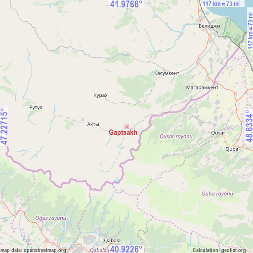
Gaptsakh GPS coordinates[2]
41° 27' 6.264" North, 47° 55' 48.972" East
| Map corner | latitude | longitude |
|---|---|---|
| Upper-left | 41.9766°, | 47.22715° |
| Center: | 41.45174°, | 47.93027° |
| Lower-right: | 40.9226°, | 48.6334° |
| Map W x H: | 117.2×117.2 km | = 72.8×72.8mi |
| max Lat: | 73.50819° ⇑99.9% North |
| Gaptsakh: | 41.45174° |
| min Lat: | ⇓0.1% South 41.28413° |
| min Long | Gaptsakh | max Long |
| -179.12198° | 47.93027° | 179.35046° |
| W 58.6%⇐ | ⇒41.4% E |
Elevation
Elevation of Gaptsakh is 1185 m = 3888 ft, and this is 982.4 m = 3223 ft above average elevation for this country.
| Max E: |
2518 m = 8261 ft | 1% |
| Gaptsakh | 1185 m 3888 ft | |
| Avg. | 202.6 m = 665 ft | |
Min E: |
-28 m = -92 ft | 99% |
See also: Russia elevation on elevation.city.
Geographical zone
Gaptsakh is located in North temperate zone (between Tropic of Cancer and the Arctic Circle). Distance of this Northern Tropic circle is 2003.1 km =1244.7 mi to South.| Distance of | km | miles | from Gaptsakh |
|---|---|---|---|
| North Pole | 5398.1 | 3354.2 | to North |
| Arctic Circle | 2792.2 | 1735 | to North |
| Tropic Cancer | 2003.1 | 1244.7 | to South |
| Equator | 4609 | 2863.9 | to South |


Nearby cities:
15 places around Gaptsakh: (largest is in red/bold)
• Akhty
16.6 km =10.3 mi,  273°
273°
• Gereykhanovskoye
40.3 km =25 mi,  46°
46°
• Kasumkent
30.8 km =19.1 mi,  35°
35°
• Khiv
33.6 km =20.9 mi,  0°
0°
• Kurakh
19.2 km =11.9 mi,  320°
320°
• Kurkent
32.8 km =20.4 mi,  28°
28°
• Kurush
20.3 km =12.6 mi,  203°
203°
• Lutkun
20.6 km =12.8 mi,  279°
279°
• Magaramkent
39.3 km =24.4 mi,  62°
62°
• Miskindzha
7.6 km =4.7 mi,  246°
246°
• Novaya Maka
50.5 km =31.4 mi, 45°
• Rutul
43.2 km =26.8 mi, 282°
• Syrtych
49.2 km =30.6 mi, 30°
• Tpig
46.2 km =28.7 mi, 322°
• Usukhchay
3.6 km =2.2 mi, 203°
Sources, notices
• [Note1] Compared only with cities in Russia existing in our database
• [Src1] Map data: © OpenStreetMap contributors (CC-BY-SA)
• [Src2] Other city data from geonames.org with taken over terms of usage.
• [Src3] Geographical zone / Annual Mean Temperature by Robert A. Rohde @ Wikipedia
