Gereykhanovskoye geodata
Gereykhanovskoye (Dagestan) is a populated place; located in Russia in Europe/Moscow (GMT+3) time zone. With population of 3,418 people, there are 3459 cities with bigger population in this country. Compared to other cities in Russia, 99.8% of cities are located further ↑North; 59.5% of cities are located further ←West and 84.4% of cities have lower elevation than Gereykhanovskoye. Note1


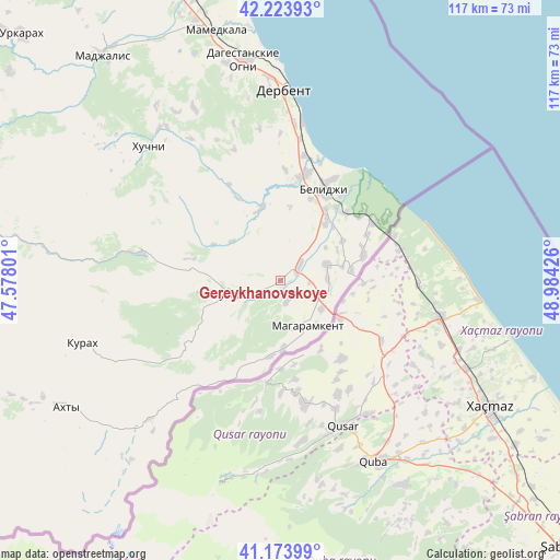
Gereykhanovskoye GPS coordinates[2]
41° 42' 3.96" North, 48° 16' 52.068" East
| Map corner | latitude | longitude |
|---|---|---|
| Upper-left | 42.22393°, | 47.57801° |
| Center: | 41.7011°, | 48.28113° |
| Lower-right: | 41.17399°, | 48.98426° |
| Map W x H: | 116.7×116.7 km | = 72.5×72.5mi |
| max Lat: | 73.50819° ⇑99.8% North |
| Gereykhanovskoye: | 41.7011° |
| min Lat: | ⇓0.2% South 41.28413° |
| min Long | Gereykhanovskoy | max Long |
| -179.12198° | 48.28113° | 179.35046° |
| W 59.5%⇐ | ⇒40.5% E |
Elevation
Elevation of Gereykhanovskoye is 312 m = 1024 ft, and this is 109.4 m = 359 ft above average elevation for this country.
| Max E: |
2518 m = 8261 ft | 15.6% |
| Gereykhanovskoye | 312 m 1024 ft | |
| Avg. | 202.6 m = 665 ft | |
Min E: |
-28 m = -92 ft | 84.4% |
See also: Russia elevation on elevation.city.
Geographical zone
Gereykhanovskoye is located in North temperate zone (between Tropic of Cancer and the Arctic Circle). Distance of this Northern Tropic circle is 2030.8 km =1261.9 mi to South.| Distance of | km | miles | from Gereykhanovskoye |
|---|---|---|---|
| North Pole | 5370.3 | 3336.9 | to North |
| Arctic Circle | 2764.4 | 1717.7 | to North |
| Tropic Cancer | 2030.8 | 1261.9 | to South |
| Equator | 4636.7 | 2881.1 | to South |


Nearby cities:
15 places around Gereykhanovskoye: (largest is in red/bold)
• Belidzhi
23.8 km =14.8 mi,  27°
27°
• Derbent
40.8 km =25.4 mi,  1°
1°
• Gaptsakh
40.3 km =25 mi,  226°
226°
• Kasumkent
11.5 km =7.1 mi,  256°
256°
• Khazar
33.2 km =20.6 mi,  7°
7°
• Khiv
29.7 km =18.5 mi,  281°
281°
• Khuchni
39 km =24.2 mi,  315°
315°
• Kurakh
43.4 km =27 mi,  252°
252°
• Kurkent
13.8 km =8.6 mi, 275°
• Magaramkent
11 km =6.8 mi,  149°
149°
• Novaya Maka
10.3 km =6.4 mi,  40°
40°
• Sabnova
40.3 km =25 mi,  356°
356°
• Samur
21.9 km =13.6 mi,  50°
50°
• Syrtych
15.4 km =9.6 mi,  343°
343°
• Usukhchay
43.6 km =27.1 mi,  224°
224°
Sources, notices
• [Note1] Compared only with cities in Russia existing in our database
• [Src1] Map data: © OpenStreetMap contributors (CC-BY-SA)
• [Src2] Other city data from geonames.org with taken over terms of usage.
• [Src3] Geographical zone / Annual Mean Temperature by Robert A. Rohde @ Wikipedia
