Dvinskoy geodata
Dvinskoy (Arkhangelskaya) is a populated place; located in Russia in Europe/Moscow (GMT+3) time zone. With population of 2,845 people, there are 3847 cities with bigger population in this country. Compared to other cities in Russia, 95.1% of cities are located further ↓South; 50.5% of cities are located further ←West and 82.2% of cities have higher elevation than Dvinskoy. Note1


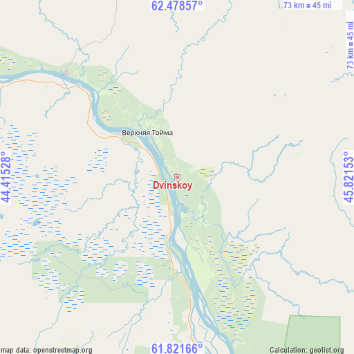
Dvinskoy GPS coordinates[2]
62° 9' 6.84" North, 45° 7' 6.24" East
| Map corner | latitude | longitude |
|---|---|---|
| Upper-left | 62.47857°, | 44.41528° |
| Center: | 62.1519°, | 45.1184° |
| Lower-right: | 61.82166°, | 45.82153° |
| Map W x H: | 73×73 km | = 45.4×45.4mi |
| max Lat: | 73.50819° ⇑4.9% North |
| Dvinskoy: | 62.1519° |
| min Lat: | ⇓95.1% South 41.28413° |
| min Long | Dvinskoy | max Long |
| -179.12198° | 45.1184° | 179.35046° |
| W 50.5%⇐ | ⇒49.5% E |
Elevation
Elevation of Dvinskoy is 62 m = 203 ft, and this is 140.6 m = 461 ft below average elevation for this country.
| Max E: |
2518 m = 8261 ft | 82.2% |
| Avg. | 202.6 m = 665 ft | |
| Dvinskoy | 62 m = 203 ft | |
Min E: |
-28 m = -92 ft | 17.8% |
See also: Russia elevation on elevation.city.
Geographical zone
Dvinskoy is located in North temperate zone (between Tropic of Cancer and the Arctic Circle). Distance of this North polar circle is 490.5 km =304.8 mi to North.| Distance of | km | miles | from Dvinskoy |
|---|---|---|---|
| North Pole | 3096.4 | 1924 | to North |
| Arctic Circle | 490.5 | 304.8 | to North |
| Tropic Cancer | 4304.7 | 2674.8 | to South |
| Equator | 6910.6 | 4294 | to South |


Nearby cities:
15 places around Dvinskoy: (largest is in red/bold)
• Berëznik
128.8 km =80 mi,  217°
217°
• Ileza
138.1 km =85.8 mi,  207°
207°
• Kizema
116.5 km =72.4 mi,  187°
187°
• Kotlas
128.1 km =79.6 mi,  140°
140°
• Krasnoborsk
78.5 km =48.8 mi,  146°
146°
• Loyga
122.4 km =76.1 mi, 192°
• Mirnyy
96.1 km =59.7 mi,  198°
198°
• Privodino
140.2 km =87.1 mi, 148°
• Rochegda
104.9 km =65.2 mi,  303°
303°
• Shenkursk
115.6 km =71.8 mi,  267°
267°
• Shipitsyno
121.8 km =75.7 mi, 142°
• Sol’vychegodsk
131.5 km =81.7 mi,  133°
133°
• Udimskiy
119.9 km =74.5 mi,  159°
159°
• Verkhnyaya Toyma
11 km =6.8 mi,  326°
326°
• Vychegodskiy
137.6 km =85.5 mi, 136°
Sources, notices
• [Note1] Compared only with cities in Russia existing in our database
• [Src1] Map data: © OpenStreetMap contributors (CC-BY-SA)
• [Src2] Other city data from geonames.org with taken over terms of usage.
• [Src3] Geographical zone / Annual Mean Temperature by Robert A. Rohde @ Wikipedia
