Berëznik geodata
Berëznik (Arkhangelskaya) is a populated place; located in Russia in Europe/Moscow (GMT+3) time zone. With population of 695 people, there are 4823 cities with bigger population in this country. Compared to other cities in Russia, 93.5% of cities are located further ↓South; 54.3% of cities are located further →East and 73.4% of cities have higher elevation than Berëznik. Note1


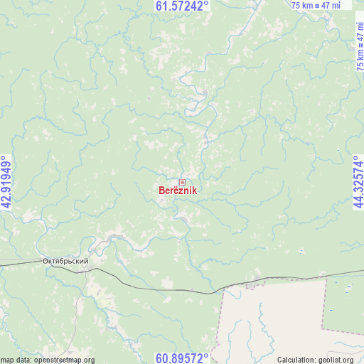
Berëznik GPS coordinates[2]
61° 14' 9.204" North, 43° 37' 21.396" East
| Map corner | latitude | longitude |
|---|---|---|
| Upper-left | 61.57242°, | 42.91949° |
| Center: | 61.23589°, | 43.62261° |
| Lower-right: | 60.89572°, | 44.32574° |
| Map W x H: | 75.2×75.2 km | = 46.7×46.7mi |
| max Lat: | 73.50819° ⇑6.5% North |
| Berëznik: | 61.23589° |
| min Lat: | ⇓93.5% South 41.28413° |
| min Long | Berëznik | max Long |
| -179.12198° | 43.62261° | 179.35046° |
| W 45.7%⇐ | ⇒54.3% E |
Elevation
Elevation of Berëznik is 93 m = 305 ft, and this is 109.6 m = 360 ft below average elevation for this country.
| Max E: |
2518 m = 8261 ft | 73.4% |
| Avg. | 202.6 m = 665 ft | |
| Berëznik | 93 m = 305 ft | |
Min E: |
-28 m = -92 ft | 26.6% |
See also: Russia elevation on elevation.city.
Geographical zone
Berëznik is located in North temperate zone (between Tropic of Cancer and the Arctic Circle). Distance of this North polar circle is 592.4 km =368.1 mi to North.| Distance of | km | miles | from Berëznik |
|---|---|---|---|
| North Pole | 3198.3 | 1987.3 | to North |
| Arctic Circle | 592.4 | 368.1 | to North |
| Tropic Cancer | 4202.9 | 2611.6 | to South |
| Equator | 6808.8 | 4230.8 | to South |


Nearby cities:
15 places around Berëznik: (largest is in red/bold)
• Ileza
25.2 km =15.7 mi,  143°
143°
• Kizema
66.2 km =41.1 mi,  101°
101°
• Krasnoborsk
128.2 km =79.7 mi,  73°
73°
• Kuloy
64.8 km =40.3 mi,  249°
249°
• Loyga
55.7 km =34.6 mi,  108°
108°
• Mirnyy
50 km =31.1 mi,  77°
77°
• Nyuksenitsa
97.4 km =60.5 mi,  160°
160°
• Shangaly
19.5 km =12.1 mi,  232°
232°
• Shenkursk
104.4 km =64.9 mi,  338°
338°
• Solginskiy
124.1 km =77.1 mi,  260°
260°
• Tarnogskiy Gorodok
81.9 km =50.9 mi,  181°
181°
• Udimskiy
123.2 km =76.6 mi,  94°
94°
• Ust’-Shonosha
122.5 km =76.1 mi,  265°
265°
• Vel’sk
83.8 km =52.1 mi, 257°
• Verkhovazh’ye
100.9 km =62.7 mi,  237°
237°
Sources, notices
• [Note1] Compared only with cities in Russia existing in our database
• [Src1] Map data: © OpenStreetMap contributors (CC-BY-SA)
• [Src2] Other city data from geonames.org with taken over terms of usage.
• [Src3] Geographical zone / Annual Mean Temperature by Robert A. Rohde @ Wikipedia
