Donskoy geodata
Donskoy (Tula) is a populated place; located in Russia in Europe/Moscow (GMT+3) time zone. With population of 31,968 people, there are 620 cities with bigger population in this country. Compared to other cities in Russia, 55.5% of cities are located further ↑North; 75.2% of cities are located further →East and 76.9% of cities have lower elevation than Donskoy. Note1


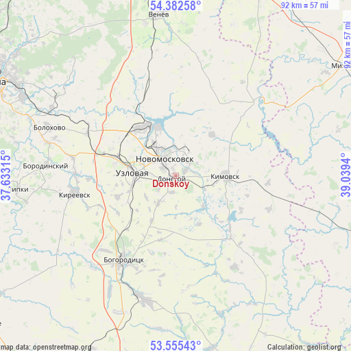
Donskoy GPS coordinates[2]
53° 58' 15.816" North, 38° 20' 10.572" East
| Map corner | latitude | longitude |
|---|---|---|
| Upper-left | 54.38258°, | 37.63315° |
| Center: | 53.97106°, | 38.33627° |
| Lower-right: | 53.55543°, | 39.0394° |
| Map W x H: | 92×92 km | = 57.2×57.2mi |
| max Lat: | 73.50819° ⇑55.5% North |
| Donskoy: | 53.97106° |
| min Lat: | ⇓44.5% South 41.28413° |
| min Long | Donskoy | max Long |
| -179.12198° | 38.33627° | 179.35046° |
| W 24.8%⇐ | ⇒75.2% E |
Elevation
Elevation of Donskoy is 226 m = 741 ft, and this is 23.4 m = 77 ft above average elevation for this country.
| Max E: |
2518 m = 8261 ft | 23.1% |
| Donskoy | 226 m 741 ft | |
| Avg. | 202.6 m = 665 ft | |
Min E: |
-28 m = -92 ft | 76.9% |
See also: Russia elevation on elevation.city.
Geographical zone
Donskoy is located in North temperate zone (between Tropic of Cancer and the Arctic Circle). Distance of this North polar circle is 1400.2 km =870 mi to North.| Distance of | km | miles | from Donskoy |
|---|---|---|---|
| North Pole | 4006 | 2489.2 | to North |
| Arctic Circle | 1400.2 | 870 | to North |
| Tropic Cancer | 3395.1 | 2109.6 | to South |
| Equator | 6001 | 3728.8 | to South |


Nearby cities:
15 places around Donskoy: (largest is in red/bold)
• Begichevskiy
20.2 km =12.6 mi,  195°
195°
• Bogoroditsk
26.2 km =16.3 mi,  212°
212°
• Brusyanka
19.7 km =12.2 mi,  274°
274°
• Dubovka
18 km =11.2 mi,  263°
263°
• Gritsovskiy
21.8 km =13.5 mi,  328°
328°
• Kamenetskiy
8.9 km =5.5 mi,  302°
302°
• Kimovsk
12.8 km =8 mi,  89°
89°
• Mayskiy
8.2 km =5.1 mi, 263°
• Novomoskovsk
5.5 km =3.4 mi,  322°
322°
• Partizan
15.8 km =9.8 mi, 261°
• Podlesnyy
5.6 km =3.5 mi,  232°
232°
• Severo-Zadonsk
8.3 km =5.2 mi,  31°
31°
• Uzlovaya
10.9 km =6.8 mi,  276°
276°
• Yepifan’
21.5 km =13.4 mi,  138°
138°
• Zhdankovskiy
26.3 km =16.3 mi, 202°
Sources, notices
• [Note1] Compared only with cities in Russia existing in our database
• [Src1] Map data: © OpenStreetMap contributors (CC-BY-SA)
• [Src2] Other city data from geonames.org with taken over terms of usage.
• [Src3] Geographical zone / Annual Mean Temperature by Robert A. Rohde @ Wikipedia
