Kuvandyk geodata
Kuvandyk (Orenburg Oblast) is a populated place; located in Russia in Asia/Yekaterinburg (GMT+5) time zone. With population of 28,706 people, there are 682 cities with bigger population in this country. Compared to other cities in Russia, 72.7% of cities are located further ↑North; 68.8% of cities are located further ←West and 73.7% of cities have lower elevation than Kuvandyk. Note1


Kuvandyk GPS coordinates[2]
51° 28' 41.16" North, 57° 21' 18.72" East
| Map corner | latitude | longitude |
|---|---|---|
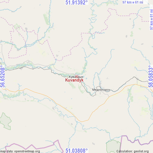
| Upper-left | 51.91392°, | 56.65208° |
| Center: | 51.4781°, | 57.3552° |
| Lower-right: | 51.03808°, | 58.05833° |
| Map W x H: | 97.4×97.4 km | = 60.5×60.5mi |
| max Lat: | 73.50819° ⇑72.7% North |
| Kuvandyk: | 51.4781° |
| min Lat: | ⇓27.3% South 41.28413° |
| min Long | Kuvandyk | max Long |
| -179.12198° | 57.3552° | 179.35046° |
| W 68.8%⇐ | ⇒31.2% E |
Elevation
Elevation of Kuvandyk is 211 m = 692 ft, and this is 8.4 m = 28 ft above average elevation for this country.
| Max E: |
2518 m = 8261 ft | 26.3% |
| Kuvandyk | 211 m 692 ft | |
| Avg. | 202.6 m = 665 ft | |
Min E: |
-28 m = -92 ft | 73.7% |
See also: Russia elevation on elevation.city.
Geographical zone
Kuvandyk is located in North temperate zone (between Tropic of Cancer and the Arctic Circle). Distance of this North polar circle is 1677.3 km =1042.2 mi to North.| Distance of | km | miles | from Kuvandyk |
|---|---|---|---|
| North Pole | 4283.2 | 2661.5 | to North |
| Arctic Circle | 1677.3 | 1042.2 | to North |
| Tropic Cancer | 3117.9 | 1937.4 | to South |
| Equator | 5723.8 | 3556.6 | to South |


Nearby cities:
15 places around Kuvandyk: (largest is in red/bold)
• Ak”yar
73.2 km =45.5 mi,  54°
54°
• Belyayevka
65.7 km =40.8 mi,  262°
262°
• Buribay
77.2 km =48 mi, 45°
• Dubenskiy
50.1 km =31.1 mi,  267°
267°
• Energetik
103.6 km =64.4 mi,  73°
73°
• Gay
76.2 km =47.3 mi,  90°
90°
• Isyangulovo
95 km =59 mi,  325°
325°
• Matveyevka
109.9 km =68.3 mi,  312°
312°
• Mednogorsk
18.1 km =11.2 mi,  113°
113°
• Novorudnyy
57.7 km =35.9 mi, 87°
• Novotroitsk
74.1 km =46 mi, 114°
• Orsk
89.5 km =55.6 mi, 109°
• Saraktash
76.8 km =47.7 mi,  296°
296°
• Staraya Akkermanovka
66.5 km =41.3 mi, 112°
• Zilair
84.2 km =52.3 mi,  3°
3°
Sources, notices
• [Note1] Compared only with cities in Russia existing in our database
• [Src1] Map data: © OpenStreetMap contributors (CC-BY-SA)
• [Src2] Other city data from geonames.org with taken over terms of usage.
• [Src3] Geographical zone / Annual Mean Temperature by Robert A. Rohde @ Wikipedia
