Besleney geodata
Besleney (Karachayevo-Cherkesiya Republic) is a populated place; located in Russia in Europe/Moscow (GMT+3) time zone. With population of 3,189 people, there are 3616 cities with bigger population in this country. Compared to other cities in Russia, 90.5% of cities are located further ↑North; 60.7% of cities are located further →East and 93.7% of cities have lower elevation than Besleney. Note1


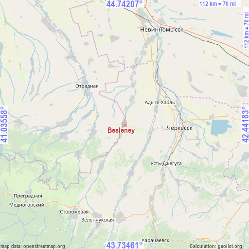
Besleney GPS coordinates[2]
44° 14' 25.8" North, 41° 44' 19.32" East
| Map corner | latitude | longitude |
|---|---|---|
| Upper-left | 44.74207°, | 41.03558° |
| Center: | 44.2405°, | 41.7387° |
| Lower-right: | 43.73461°, | 42.44183° |
| Map W x H: | 112×112 km | = 69.6×69.6mi |
| max Lat: | 73.50819° ⇑90.5% North |
| Besleney: | 44.2405° |
| min Lat: | ⇓9.5% South 41.28413° |
| min Long | Besleney | max Long |
| -179.12198° | 41.7387° | 179.35046° |
| W 39.3%⇐ | ⇒60.7% E |
Elevation
Elevation of Besleney is 570 m = 1870 ft, and this is 367.4 m = 1205 ft above average elevation for this country.
| Max E: |
2518 m = 8261 ft | 6.3% |
| Besleney | 570 m 1870 ft | |
| Avg. | 202.6 m = 665 ft | |
Min E: |
-28 m = -92 ft | 93.7% |
See also: Russia elevation on elevation.city.
Geographical zone
Besleney is located in North temperate zone (between Tropic of Cancer and the Arctic Circle). Distance of this Northern Tropic circle is 2313.2 km =1437.4 mi to South.| Distance of | km | miles | from Besleney |
|---|---|---|---|
| North Pole | 5088 | 3161.5 | to North |
| Arctic Circle | 2482.1 | 1542.3 | to North |
| Tropic Cancer | 2313.2 | 1437.4 | to South |
| Equator | 4919.1 | 3056.6 | to South |


Nearby cities:
15 places around Besleney: (largest is in red/bold)
• Adyge-Khabl’
19.1 km =11.9 mi,  56°
56°
• Ali-Berdukovskiy
27.9 km =17.3 mi,  179°
179°
• Cherkessk
25.5 km =15.8 mi,  94°
94°
• Druzhba
22.7 km =14.1 mi,  102°
102°
• Ikon-Khalk
15.7 km =9.8 mi, 62°
• Ispravnaya
21.7 km =13.5 mi,  208°
208°
• Khabez
22.1 km =13.7 mi,  173°
173°
• Otradnaya
24.3 km =15.1 mi,  314°
314°
• Peredovaya
25.1 km =15.6 mi,  236°
236°
• Poputnaya
38.5 km =23.9 mi,  321°
321°
• Pravokubanskiy
37.8 km =23.5 mi,  162°
162°
• Psyzh
22.3 km =13.9 mi, 92°
• Spokoynaya
26.9 km =16.7 mi,  271°
271°
• Udobnaya
15.7 km =9.8 mi,  250°
250°
• Ust’-Dzheguta
25.8 km =16 mi,  132°
132°
Sources, notices
• [Note1] Compared only with cities in Russia existing in our database
• [Src1] Map data: © OpenStreetMap contributors (CC-BY-SA)
• [Src2] Other city data from geonames.org with taken over terms of usage.
• [Src3] Geographical zone / Annual Mean Temperature by Robert A. Rohde @ Wikipedia
