Alekseyevka geodata
Alekseyevka (Moscow Oblast) is a section of populated place; located in Russia in Europe/Moscow (GMT+3) time zone. With population of 78,000 people, there are 266 cities with bigger population in this country. Compared to other cities in Russia, 60.3% of cities are located further ↓South; 78.9% of cities are located further →East and 51.1% of cities have higher elevation than Alekseyevka. Note1


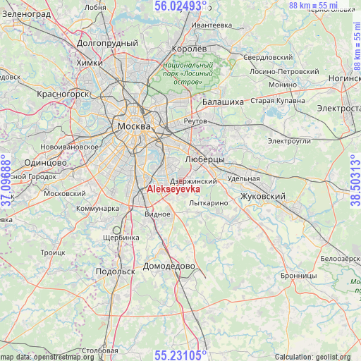
Alekseyevka GPS coordinates[2]
55° 37' 48" North, 37° 48' 0" East
| Map corner | latitude | longitude |
|---|---|---|
| Upper-left | 56.02493°, | 37.09688° |
| Center: | 55.63°, | 37.8° |
| Lower-right: | 55.23105°, | 38.50313° |
| Map W x H: | 88.3×88.3 km | = 54.9×54.9mi |
| max Lat: | 73.50819° ⇑39.7% North |
| Alekseyevka: | 55.63° |
| min Lat: | ⇓60.3% South 41.28413° |
| min Long | Alekseyevka | max Long |
| -179.12198° | 37.8° | 179.35046° |
| W 21.1%⇐ | ⇒78.9% E |
Elevation
Elevation of Alekseyevka is 142 m = 466 ft, and this is 60.6 m = 199 ft below average elevation for this country.
| Max E: |
2518 m = 8261 ft | 51.1% |
| Avg. | 202.6 m = 665 ft | |
| Alekseyevka | 142 m = 466 ft | |
Min E: |
-28 m = -92 ft | 48.9% |
See also: Alekseyevka elevation on elevation.city.
Geographical zone
Alekseyevka is located in North temperate zone (between Tropic of Cancer and the Arctic Circle). Distance of this North polar circle is 1215.7 km =755.4 mi to North.| Distance of | km | miles | from Alekseyevka |
|---|---|---|---|
| North Pole | 3821.6 | 2374.6 | to North |
| Arctic Circle | 1215.7 | 755.4 | to North |
| Tropic Cancer | 3579.6 | 2224.3 | to South |
| Equator | 6185.5 | 3843.5 | to South |


Nearby cities:
15 places around Alekseyevka: (largest is in red/bold)
• Brateyevo
2.4 km =1.5 mi,  290°
290°
• Dzerzhinskiy
3.5 km =2.2 mi,  90°
90°
• Dzerzhinsky
3.7 km =2.3 mi, 94°
• Kapotnya
1 km =0.6 mi,  334°
334°
• Kotel’niki
2.9 km =1.8 mi,  77°
77°
• Kur’yanovo
6.7 km =4.2 mi, 289°
• Kuz’minki
7.8 km =4.8 mi,  0°
0°
• Lyubertsy
7.9 km =4.9 mi,  48°
48°
• Lyublino
5.8 km =3.6 mi, 334°
• Mar’ino
5.7 km =3.5 mi, 293°
• Orekhovo-Borisovo
5 km =3.1 mi,  247°
247°
• Orekhovo-Borisovo Severnoye
7.5 km =4.7 mi,  258°
258°
• Orekhovo-Borisovo Yuzhnoye
4.2 km =2.6 mi,  275°
275°
• Razvilka
5.6 km =3.5 mi,  221°
221°
• Zyablikovo
2.6 km =1.6 mi,  234°
234°
Sources, notices
• [Note1] Compared only with cities in Russia existing in our database
• [Src1] Map data: © OpenStreetMap contributors (CC-BY-SA)
• [Src2] Other city data from geonames.org with taken over terms of usage.
• [Src3] Geographical zone / Annual Mean Temperature by Robert A. Rohde @ Wikipedia
