Priladozhskiy geodata
Priladozhskiy (Leningradskaya Oblast') is a populated place; located in Russia in Europe/Moscow (GMT+3) time zone. With population of 5,159 people, there are 2573 cities with bigger population in this country. Compared to other cities in Russia, 89.3% of cities are located further ↓South; 94.1% of cities are located further →East and 83.7% of cities have higher elevation than Priladozhskiy. Note1


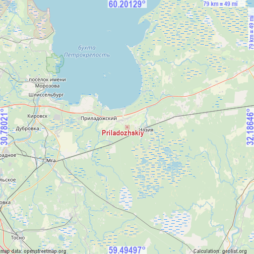
Priladozhskiy GPS coordinates[2]
59° 51' 0" North, 31° 28' 59.988" East
| Map corner | latitude | longitude |
|---|---|---|
| Upper-left | 60.20129°, | 30.78021° |
| Center: | 59.85°, | 31.48333° |
| Lower-right: | 59.49497°, | 32.18646° |
| Map W x H: | 78.5×78.5 km | = 48.8×48.8mi |
| max Lat: | 73.50819° ⇑10.7% North |
| Priladozhskiy: | 59.85° |
| min Lat: | ⇓89.3% South 41.28413° |
| min Long | Priladozhskiy | max Long |
| -179.12198° | 31.48333° | 179.35046° |
| W 5.9%⇐ | ⇒94.1% E |
Elevation
Elevation of Priladozhskiy is 54 m = 177 ft, and this is 148.6 m = 488 ft below average elevation for this country.
| Max E: |
2518 m = 8261 ft | 83.7% |
| Avg. | 202.6 m = 665 ft | |
| Priladozhskiy | 54 m = 177 ft | |
Min E: |
-28 m = -92 ft | 16.3% |
See also: Russia elevation on elevation.city.
Geographical zone
Priladozhskiy is located in North temperate zone (between Tropic of Cancer and the Arctic Circle). Distance of this North polar circle is 746.5 km =463.9 mi to North.| Distance of | km | miles | from Priladozhskiy |
|---|---|---|---|
| North Pole | 3352.4 | 2083.1 | to North |
| Arctic Circle | 746.5 | 463.9 | to North |
| Tropic Cancer | 4048.8 | 2515.8 | to South |
| Equator | 6654.7 | 4135 | to South |


Nearby cities:
15 places around Priladozhskiy: (largest is in red/bold)
• Borisova Griva
38.7 km =24 mi,  313°
313°
• Imeni Morozova
28.5 km =17.7 mi,  299°
299°
• Imeni Sverdlova
46.1 km =28.6 mi,  262°
262°
• Kirovsk
27.5 km =17.1 mi,  277°
277°
• Koltushi
47.6 km =29.6 mi, 280°
• Mga
25.8 km =16 mi,  244°
244°
• Nikol’skoye
42.5 km =26.4 mi,  246°
246°
• Nurma
42.4 km =26.3 mi,  218°
218°
• Otradnoye
38.1 km =23.7 mi, 257°
• Pavlovo
33.1 km =20.6 mi, 262°
• Sapërnyy
46.7 km =29 mi, 259°
• Shcheglovo
45.3 km =28.1 mi, 295°
• Shlissel’burg
27.1 km =16.8 mi,  293°
293°
• Sinyavino
23.9 km =14.9 mi, 285°
• Ul’yanovka
46.6 km =29 mi, 239°
Sources, notices
• [Note1] Compared only with cities in Russia existing in our database
• [Src1] Map data: © OpenStreetMap contributors (CC-BY-SA)
• [Src2] Other city data from geonames.org with taken over terms of usage.
• [Src3] Geographical zone / Annual Mean Temperature by Robert A. Rohde @ Wikipedia
