Uchkent geodata
Uchkent (Dagestan) is a populated place; located in Russia in Europe/Moscow (GMT+3) time zone. With population of 3,380 people, there are 3473 cities with bigger population in this country. Compared to other cities in Russia, 97% of cities are located further ↑North; 56.2% of cities are located further ←West and 60.6% of cities have higher elevation than Uchkent. Note1


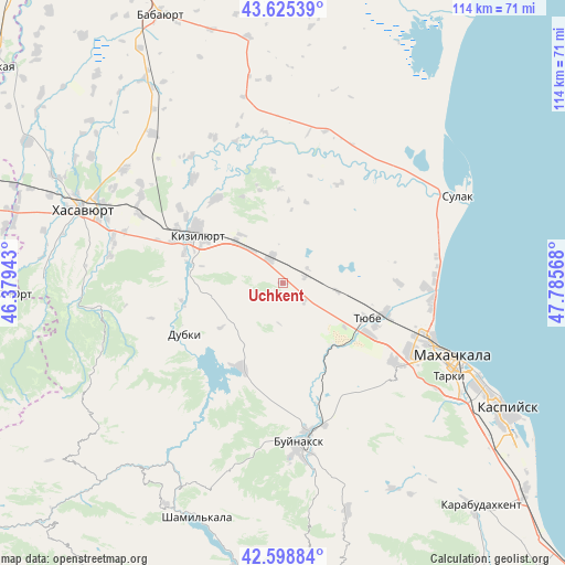
Uchkent GPS coordinates[2]
43° 6' 51.372" North, 47° 4' 57.18" East
| Map corner | latitude | longitude |
|---|---|---|
| Upper-left | 43.62539°, | 46.37943° |
| Center: | 43.11427°, | 47.08255° |
| Lower-right: | 42.59884°, | 47.78568° |
| Map W x H: | 114.1×114.1 km | = 70.9×70.9mi |
| max Lat: | 73.50819° ⇑97% North |
| Uchkent: | 43.11427° |
| min Lat: | ⇓3% South 41.28413° |
| min Long | Uchkent | max Long |
| -179.12198° | 47.08255° | 179.35046° |
| W 56.2%⇐ | ⇒43.8% E |
Elevation
Elevation of Uchkent is 123 m = 404 ft, and this is 79.6 m = 261 ft below average elevation for this country.
| Max E: |
2518 m = 8261 ft | 60.6% |
| Avg. | 202.6 m = 665 ft | |
| Uchkent | 123 m = 404 ft | |
Min E: |
-28 m = -92 ft | 39.4% |
See also: Russia elevation on elevation.city.
Geographical zone
Uchkent is located in North temperate zone (between Tropic of Cancer and the Arctic Circle). Distance of this Northern Tropic circle is 2187.9 km =1359.5 mi to South.| Distance of | km | miles | from Uchkent |
|---|---|---|---|
| North Pole | 5213.2 | 3239.3 | to North |
| Arctic Circle | 2607.3 | 1620.1 | to North |
| Tropic Cancer | 2187.9 | 1359.5 | to South |
| Equator | 4793.9 | 2978.8 | to South |


Nearby cities:
15 places around Uchkent: (largest is in red/bold)
• Bavtugay
21 km =13 mi,  286°
286°
• Chirkey
19 km =11.8 mi,  206°
206°
• Chontaul
27.8 km =17.3 mi,  319°
319°
• Dubki
22.4 km =13.9 mi,  242°
242°
• Kizilyurt
18 km =11.2 mi,  297°
297°
• Korkmaskala
19.9 km =12.4 mi,  120°
120°
• Leninkent
27.2 km =16.9 mi,  126°
126°
• Miatli
20.9 km =13 mi,  260°
260°
• Novyy Chirkey
5.7 km =3.5 mi,  337°
337°
• Novyy Sulak
22.1 km =13.7 mi, 289°
• Shamkhal
21.6 km =13.4 mi,  106°
106°
• Shamkhal-Termen
20.6 km =12.8 mi, 115°
• Temiraul
25.9 km =16.1 mi,  306°
306°
• Tyube
19.6 km =12.2 mi, 111°
• Zubutli-Miatli
23.8 km =14.8 mi, 293°
Sources, notices
• [Note1] Compared only with cities in Russia existing in our database
• [Src1] Map data: © OpenStreetMap contributors (CC-BY-SA)
• [Src2] Other city data from geonames.org with taken over terms of usage.
• [Src3] Geographical zone / Annual Mean Temperature by Robert A. Rohde @ Wikipedia
