Yemel’yanovo geodata
Yemel’yanovo (Krasnoyarskiy) is a populated place; located in Russia in Asia/Krasnoyarsk (GMT+7) time zone. With population of 10,800 people, there are 1398 cities with bigger population in this country. Compared to other cities in Russia, 68.8% of cities are located further ↓South; 86.6% of cities are located further ←West and 73.7% of cities have lower elevation than Yemel’yanovo. Note1


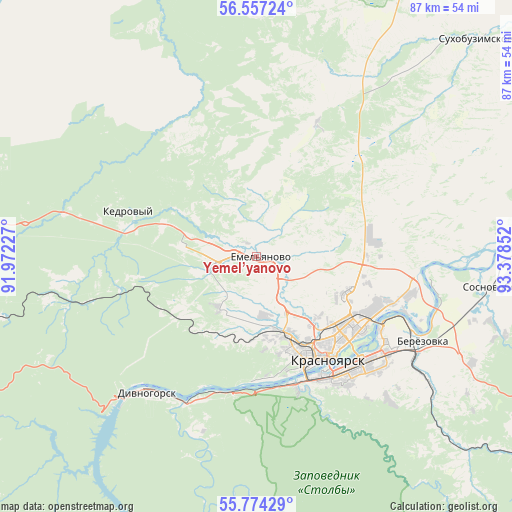
Yemel’yanovo GPS coordinates[2]
56° 10' 3.936" North, 92° 40' 31.404" East
| Map corner | latitude | longitude |
|---|---|---|
| Upper-left | 56.55724°, | 91.97227° |
| Center: | 56.16776°, | 92.67539° |
| Lower-right: | 55.77429°, | 93.37852° |
| Map W x H: | 87.1×87.1 km | = 54.1×54.1mi |
| max Lat: | 73.50819° ⇑31.2% North |
| Yemel’yanovo: | 56.16776° |
| min Lat: | ⇓68.8% South 41.28413° |
| min Long | Yemel’yanovo | max Long |
| -179.12198° | 92.67539° | 179.35046° |
| W 86.6%⇐ | ⇒13.4% E |
Elevation
Elevation of Yemel’yanovo is 211 m = 692 ft, and this is 8.4 m = 28 ft above average elevation for this country.
| Max E: |
2518 m = 8261 ft | 26.3% |
| Yemel’yanovo | 211 m 692 ft | |
| Avg. | 202.6 m = 665 ft | |
Min E: |
-28 m = -92 ft | 73.7% |
See also: Russia elevation on elevation.city.
Geographical zone
Yemel’yanovo is located in North temperate zone (between Tropic of Cancer and the Arctic Circle). Distance of this North polar circle is 1155.9 km =718.2 mi to North.| Distance of | km | miles | from Yemel’yanovo |
|---|---|---|---|
| North Pole | 3761.8 | 2337.5 | to North |
| Arctic Circle | 1155.9 | 718.2 | to North |
| Tropic Cancer | 3639.4 | 2261.4 | to South |
| Equator | 6245.3 | 3880.6 | to South |


Nearby cities:
15 places around Yemel’yanovo: (largest is in red/bold)
• Balakhta
109.3 km =67.9 mi,  217°
217°
• Berëzovka
31.1 km =19.3 mi,  119°
119°
• Divnogorsk
29.9 km =18.6 mi, 218°
• Kedrovyy
71.5 km =44.4 mi,  280°
280°
• Krasnoyarsk
20.4 km =12.7 mi,  144°
144°
• Novochernorechenskiy
98.5 km =61.2 mi, 276°
• Ovsyanka
24.2 km =15 mi,  195°
195°
• Predivinsk
109.9 km =68.3 mi,  25°
25°
• Shalinskoye
83.9 km =52.1 mi,  126°
126°
• Solnechnyy
16.5 km =10.3 mi,  110°
110°
• Sosnovoborsk
41.4 km =25.7 mi,  97°
97°
• Sukhobuzimskoye
52.2 km =32.4 mi,  44°
44°
• Uyar
109.9 km =68.3 mi, 111°
• Zheleznogorsk
53.8 km =33.4 mi,  80°
80°
• Zykovo
38.3 km =23.8 mi, 128°
Sources, notices
• [Note1] Compared only with cities in Russia existing in our database
• [Src1] Map data: © OpenStreetMap contributors (CC-BY-SA)
• [Src2] Other city data from geonames.org with taken over terms of usage.
• [Src3] Geographical zone / Annual Mean Temperature by Robert A. Rohde @ Wikipedia
