Balakhta geodata
Balakhta (Krasnoyarskiy) is a populated place; located in Russia in Asia/Krasnoyarsk (GMT+7) time zone. With population of 7,721 people, there are 1869 cities with bigger population in this country. Compared to other cities in Russia, 57% of cities are located further ↓South; 86.3% of cities are located further ←West and 85.1% of cities have lower elevation than Balakhta. Note1


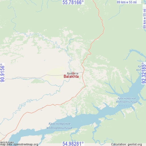
Balakhta GPS coordinates[2]
55° 23' 3.3" North, 91° 37' 7.392" East
| Map corner | latitude | longitude |
|---|---|---|
| Upper-left | 55.78166°, | 90.9156° |
| Center: | 55.38425°, | 91.61872° |
| Lower-right: | 54.98281°, | 92.32185° |
| Map W x H: | 88.8×88.8 km | = 55.2×55.2mi |
| max Lat: | 73.50819° ⇑43% North |
| Balakhta: | 55.38425° |
| min Lat: | ⇓57% South 41.28413° |
| min Long | Balakhta | max Long |
| -179.12198° | 91.61872° | 179.35046° |
| W 86.3%⇐ | ⇒13.7% E |
Elevation
Elevation of Balakhta is 321 m = 1053 ft, and this is 118.4 m = 388 ft above average elevation for this country.
| Max E: |
2518 m = 8261 ft | 14.9% |
| Balakhta | 321 m 1053 ft | |
| Avg. | 202.6 m = 665 ft | |
Min E: |
-28 m = -92 ft | 85.1% |
See also: Russia elevation on elevation.city.
Geographical zone
Balakhta is located in North temperate zone (between Tropic of Cancer and the Arctic Circle). Distance of this North polar circle is 1243 km =772.4 mi to North.| Distance of | km | miles | from Balakhta |
|---|---|---|---|
| North Pole | 3848.9 | 2391.6 | to North |
| Arctic Circle | 1243 | 772.4 | to North |
| Tropic Cancer | 3552.2 | 2207.2 | to South |
| Equator | 6158.2 | 3826.5 | to South |


Nearby cities:
15 places around Balakhta: (largest is in red/bold)
• Achinsk
120.7 km =75 mi,  324°
324°
• Berëzovka
117.9 km =73.3 mi,  52°
52°
• Divnogorsk
79.4 km =49.3 mi,  36°
36°
• Idrinskoye
117.4 km =72.9 mi,  163°
163°
• Kedrovyy
100 km =62.1 mi,  357°
357°
• Krasnoturansk
118.5 km =73.6 mi,  181°
181°
• Krasnoyarsk
105.3 km =65.4 mi, 47°
• Nazarovo
103.3 km =64.2 mi,  312°
312°
• Novochernorechenskiy
103.5 km =64.3 mi,  341°
341°
• Ovsyanka
87.4 km =54.3 mi, 43°
• Solnechnyy
115.3 km =71.6 mi, 45°
• Sosnovoborsk
135.3 km =84.1 mi, 52°
• Uzhur
113.2 km =70.3 mi,  265°
265°
• Yemel’yanovo
109.3 km =67.9 mi, 37°
• Zykovo
115.7 km =71.9 mi,  56°
56°
Sources, notices
• [Note1] Compared only with cities in Russia existing in our database
• [Src1] Map data: © OpenStreetMap contributors (CC-BY-SA)
• [Src2] Other city data from geonames.org with taken over terms of usage.
• [Src3] Geographical zone / Annual Mean Temperature by Robert A. Rohde @ Wikipedia
