Varna geodata
Varna (Chelyabinsk) is a populated place; located in Russia in Asia/Yekaterinburg (GMT+5) time zone. With population of 9,906 people, there are 1526 cities with bigger population in this country. Compared to other cities in Russia, 59.7% of cities are located further ↑North; 73.2% of cities are located further ←West and 80.2% of cities have lower elevation than Varna. Note1


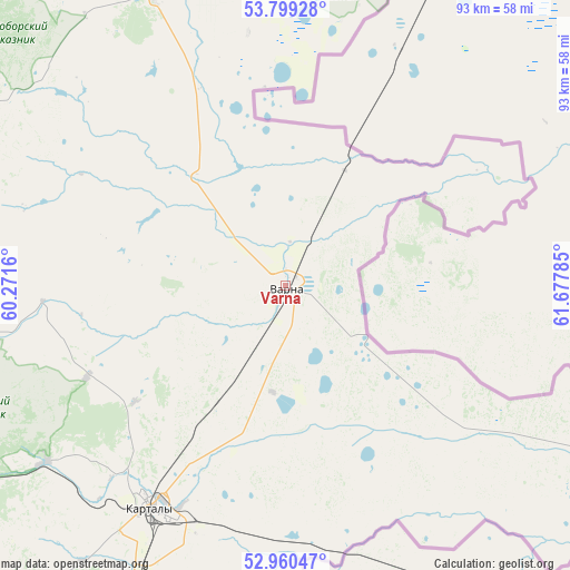
Varna GPS coordinates[2]
53° 22' 54.984" North, 60° 58' 28.992" East
| Map corner | latitude | longitude |
|---|---|---|
| Upper-left | 53.79928°, | 60.2716° |
| Center: | 53.38194°, | 60.97472° |
| Lower-right: | 52.96047°, | 61.67785° |
| Map W x H: | 93.3×93.3 km | = 58×58mi |
| max Lat: | 73.50819° ⇑59.7% North |
| Varna: | 53.38194° |
| min Lat: | ⇓40.3% South 41.28413° |
| min Long | Varna | max Long |
| -179.12198° | 60.97472° | 179.35046° |
| W 73.2%⇐ | ⇒26.8% E |
Elevation
Elevation of Varna is 250 m = 820 ft, and this is 47.4 m = 156 ft above average elevation for this country.
| Max E: |
2518 m = 8261 ft | 19.8% |
| Varna | 250 m 820 ft | |
| Avg. | 202.6 m = 665 ft | |
Min E: |
-28 m = -92 ft | 80.2% |
See also: Russia elevation on elevation.city.
Geographical zone
Varna is located in North temperate zone (between Tropic of Cancer and the Arctic Circle). Distance of this North polar circle is 1465.7 km =910.7 mi to North.| Distance of | km | miles | from Varna |
|---|---|---|---|
| North Pole | 4071.5 | 2529.9 | to North |
| Arctic Circle | 1465.7 | 910.7 | to North |
| Tropic Cancer | 3329.6 | 2068.9 | to South |
| Equator | 5935.5 | 3688.1 | to South |


Nearby cities:
15 places around Varna: (largest is in red/bold)
• Berlin
70.9 km =44.1 mi,  11°
11°
• Bobrovka
89.7 km =55.7 mi,  34°
34°
• Bredy
115.6 km =71.8 mi,  201°
201°
• Chesma
52.2 km =32.4 mi,  336°
336°
• Fershampenuaz
78.5 km =48.8 mi,  281°
281°
• Kartaly
42.5 km =26.4 mi,  210°
210°
• Kassel’skiy
103.9 km =64.6 mi,  296°
296°
• Lokomotivnyy
49.3 km =30.6 mi, 213°
• Parizh
58.8 km =36.5 mi,  260°
260°
• Plast
110.3 km =68.5 mi,  354°
354°
• Tarutino
46.4 km =28.8 mi,  4°
4°
• Troitsk
88.9 km =55.2 mi, 26°
• Uvel’skiy
120.8 km =75.1 mi, 11°
• Velikopetrovka
35.6 km =22.1 mi,  245°
245°
• Yuzhnoural’sk
119.3 km =74.1 mi, 8°
Sources, notices
• [Note1] Compared only with cities in Russia existing in our database
• [Src1] Map data: © OpenStreetMap contributors (CC-BY-SA)
• [Src2] Other city data from geonames.org with taken over terms of usage.
• [Src3] Geographical zone / Annual Mean Temperature by Robert A. Rohde @ Wikipedia
