Urengoy geodata
Urengoy (Yamalo-Nenets) is a populated place; located in Russia in Asia/Yekaterinburg (GMT+5) time zone. With population of 9,355 people, there are 1607 cities with bigger population in this country. Compared to other cities in Russia, 98% of cities are located further ↓South; 78.8% of cities are located further ←West and 94.5% of cities have higher elevation than Urengoy. Note1


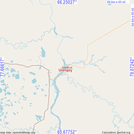
Urengoy GPS coordinates[2]
65° 57' 55.8" North, 78° 22' 9.444" East
| Map corner | latitude | longitude |
|---|---|---|
| Upper-left | 66.25027°, | 77.66617° |
| Center: | 65.9655°, | 78.36929° |
| Lower-right: | 65.67752°, | 79.07242° |
| Map W x H: | 63.7×63.7 km | = 39.6×39.6mi |
| max Lat: | 73.50819° ⇑2% North |
| Urengoy: | 65.9655° |
| min Lat: | ⇓98% South 41.28413° |
| min Long | Urengoy | max Long |
| -179.12198° | 78.36929° | 179.35046° |
| W 78.8%⇐ | ⇒21.2% E |
Elevation
Elevation of Urengoy is 14 m = 46 ft, and this is 188.6 m = 619 ft below average elevation for this country.
| Max E: |
2518 m = 8261 ft | 94.5% |
| Avg. | 202.6 m = 665 ft | |
| Urengoy | 14 m = 46 ft | |
Min E: |
-28 m = -92 ft | 5.5% |
See also: Russia elevation on elevation.city.
Geographical zone
Urengoy is located in North temperate zone (between Tropic of Cancer and the Arctic Circle). Distance of this North polar circle is 66.5 km =41.3 mi to North.| Distance of | km | miles | from Urengoy |
|---|---|---|---|
| North Pole | 2672.4 | 1660.6 | to North |
| Arctic Circle | 66.5 | 41.3 | to North |
| Tropic Cancer | 4728.8 | 2938.3 | to South |
| Equator | 7334.7 | 4557.6 | to South |


Nearby cities:
8 places around Urengoy: (largest is in red/bold)
• Gubkinskiy
191.2 km =118.8 mi,  207°
207°
• Korotchaevo
9.5 km =5.9 mi,  229°
229°
• Novyy Urengoy
79.5 km =49.4 mi,  279°
279°
• Pangody
176.7 km =109.8 mi,  265°
265°
• Purpe
182.7 km =113.5 mi, 205°
• Raduzhny
432.4 km =268.7 mi,  185°
185°
• Tarko-Sale
119.9 km =74.5 mi, 193°
• Tazovskiy
168.1 km =104.5 mi,  5°
5°
Sources, notices
• [Note1] Compared only with cities in Russia existing in our database
• [Src1] Map data: © OpenStreetMap contributors (CC-BY-SA)
• [Src2] Other city data from geonames.org with taken over terms of usage.
• [Src3] Geographical zone / Annual Mean Temperature by Robert A. Rohde @ Wikipedia
