Purpe geodata
Purpe (Yamalo-Nenets) is a populated place; located in Russia in Asia/Yekaterinburg (GMT+5) time zone. With population of 9,099 people, there are 1640 cities with bigger population in this country. Compared to other cities in Russia, 97.3% of cities are located further ↓South; 78.5% of cities are located further ←West and 84.6% of cities have higher elevation than Purpe. Note1


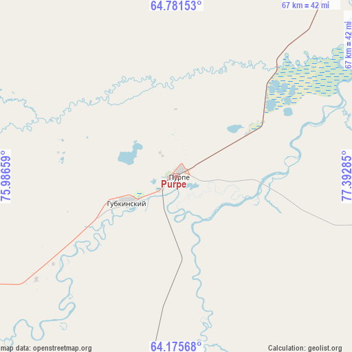
Purpe GPS coordinates[2]
64° 28' 49.008" North, 76° 41' 22.992" East
| Map corner | latitude | longitude |
|---|---|---|
| Upper-left | 64.78153°, | 75.98659° |
| Center: | 64.48028°, | 76.68972° |
| Lower-right: | 64.17568°, | 77.39285° |
| Map W x H: | 67.4×67.4 km | = 41.9×41.9mi |
| max Lat: | 73.50819° ⇑2.7% North |
| Purpe: | 64.48028° |
| min Lat: | ⇓97.3% South 41.28413° |
| min Long | Purpe | max Long |
| -179.12198° | 76.68972° | 179.35046° |
| W 78.5%⇐ | ⇒21.5% E |
Elevation
Elevation of Purpe is 49 m = 161 ft, and this is 153.6 m = 504 ft below average elevation for this country.
| Max E: |
2518 m = 8261 ft | 84.6% |
| Avg. | 202.6 m = 665 ft | |
| Purpe | 49 m = 161 ft | |
Min E: |
-28 m = -92 ft | 15.4% |
See also: Russia elevation on elevation.city.
Geographical zone
Purpe is located in North temperate zone (between Tropic of Cancer and the Arctic Circle). Distance of this North polar circle is 231.6 km =143.9 mi to North.| Distance of | km | miles | from Purpe |
|---|---|---|---|
| North Pole | 2837.5 | 1763.1 | to North |
| Arctic Circle | 231.6 | 143.9 | to North |
| Tropic Cancer | 4563.6 | 2835.7 | to South |
| Equator | 7169.5 | 4454.9 | to South |


Nearby cities:
15 places around Purpe: (largest is in red/bold)
• Gubkinskiy
10.3 km =6.4 mi,  240°
240°
• Kogalym
269.8 km =167.6 mi,  204°
204°
• Korotchaevo
174.1 km =108.2 mi,  24°
24°
• Langepas
366.4 km =227.7 mi,  191°
191°
• Muravlenko
130.1 km =80.8 mi,  233°
233°
• Novoagansk
281.9 km =175.2 mi,  180°
180°
• Novyy Urengoy
178.3 km =110.8 mi,  359°
359°
• Noyabrsk
155.7 km =96.7 mi, 203°
• Pangody
183.8 km =114.2 mi,  325°
325°
• Pokachi
314 km =195.1 mi, 192°
• Raduzhny
268 km =166.5 mi,  171°
171°
• Russkinskiye
301.1 km =187.1 mi,  210°
210°
• Tarko-Sale
70.8 km =44 mi,  46°
46°
• Tazovskiy
345 km =214.4 mi, 15°
• Urengoy
182.7 km =113.5 mi,  25°
25°
Sources, notices
• [Note1] Compared only with cities in Russia existing in our database
• [Src1] Map data: © OpenStreetMap contributors (CC-BY-SA)
• [Src2] Other city data from geonames.org with taken over terms of usage.
• [Src3] Geographical zone / Annual Mean Temperature by Robert A. Rohde @ Wikipedia
