Tazovskiy geodata
Tazovskiy (Yamalo-Nenets) is a populated place; located in Russia in Asia/Yekaterinburg (GMT+5) time zone. With population of 5,981 people, there are 2262 cities with bigger population in this country. Compared to other cities in Russia, 98.7% of cities are located further ↓South; 79% of cities are located further ←West and 89.8% of cities have higher elevation than Tazovskiy. Note1


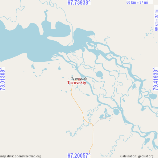
Tazovskiy GPS coordinates[2]
67° 28' 17.4" North, 78° 42' 58.32" East
| Map corner | latitude | longitude |
|---|---|---|
| Upper-left | 67.73938°, | 78.01308° |
| Center: | 67.4715°, | 78.7162° |
| Lower-right: | 67.20057°, | 79.41933° |
| Map W x H: | 59.9×59.9 km | = 37.2×37.2mi |
| max Lat: | 73.50819° ⇑1.3% North |
| Tazovskiy: | 67.4715° |
| min Lat: | ⇓98.7% South 41.28413° |
| min Long | Tazovskiy | max Long |
| -179.12198° | 78.7162° | 179.35046° |
| W 79%⇐ | ⇒21% E |
Elevation
Elevation of Tazovskiy is 29 m = 95 ft, and this is 173.6 m = 570 ft below average elevation for this country.
| Max E: |
2518 m = 8261 ft | 89.8% |
| Avg. | 202.6 m = 665 ft | |
| Tazovskiy | 29 m = 95 ft | |
Min E: |
-28 m = -92 ft | 10.2% |
See also: Russia elevation on elevation.city.
Geographical zone
Tazovskiy is located in North Frigid zone (between North Pole and Arctic Circle). Distance of this North polar circle is 101 km =62.8 mi to South.| Distance of | km | miles | from Tazovskiy |
|---|---|---|---|
| North Pole | 2504.9 | 1556.5 | to North |
| Arctic Circle | 101 | 62.8 | to South |
| Tropic Cancer | 4896.2 | 3042.4 | to South |
| Equator | 7502.1 | 4661.6 | to South |


Nearby cities:
6 places around Tazovskiy: (largest is in red/bold)
• Gubkinskiy
352.3 km =218.9 mi,  196°
196°
• Korotchaevo
175 km =108.7 mi,  187°
187°
• Novyy Urengoy
179.3 km =111.4 mi,  210°
210°
• Purpe
345 km =214.4 mi, 195°
• Tarko-Sale
287.2 km =178.5 mi, 188°
• Urengoy
168.1 km =104.5 mi, 185°
Sources, notices
• [Note1] Compared only with cities in Russia existing in our database
• [Src1] Map data: © OpenStreetMap contributors (CC-BY-SA)
• [Src2] Other city data from geonames.org with taken over terms of usage.
• [Src3] Geographical zone / Annual Mean Temperature by Robert A. Rohde @ Wikipedia
