Uporovo geodata
Uporovo (Tyumen’ Oblast) is a populated place; located in Russia in Asia/Yekaterinburg (GMT+5) time zone. With population of 5,299 people, there are 2513 cities with bigger population in this country. Compared to other cities in Russia, 70.8% of cities are located further ↓South; 76.4% of cities are located further ←West and 81.3% of cities have higher elevation than Uporovo. Note1


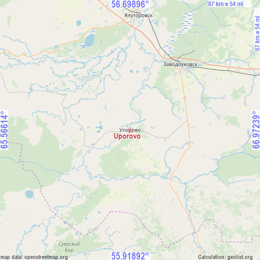
Uporovo GPS coordinates[2]
56° 18' 39.348" North, 66° 16' 9.336" East
| Map corner | latitude | longitude |
|---|---|---|
| Upper-left | 56.69896°, | 65.56614° |
| Center: | 56.31093°, | 66.26926° |
| Lower-right: | 55.91892°, | 66.97239° |
| Map W x H: | 86.7×86.7 km | = 53.9×53.9mi |
| max Lat: | 73.50819° ⇑29.2% North |
| Uporovo: | 56.31093° |
| min Lat: | ⇓70.8% South 41.28413° |
| min Long | Uporovo | max Long |
| -179.12198° | 66.26926° | 179.35046° |
| W 76.4%⇐ | ⇒23.6% E |
Elevation
Elevation of Uporovo is 66 m = 217 ft, and this is 136.6 m = 448 ft below average elevation for this country.
| Max E: |
2518 m = 8261 ft | 81.3% |
| Avg. | 202.6 m = 665 ft | |
| Uporovo | 66 m = 217 ft | |
Min E: |
-28 m = -92 ft | 18.7% |
See also: Russia elevation on elevation.city.
Geographical zone
Uporovo is located in North temperate zone (between Tropic of Cancer and the Arctic Circle). Distance of this North polar circle is 1140 km =708.4 mi to North.| Distance of | km | miles | from Uporovo |
|---|---|---|---|
| North Pole | 3745.9 | 2327.6 | to North |
| Arctic Circle | 1140 | 708.4 | to North |
| Tropic Cancer | 3655.3 | 2271.3 | to South |
| Equator | 6261.2 | 3890.5 | to South |


Nearby cities:
15 places around Uporovo: (largest is in red/bold)
• Antipino
93.8 km =58.3 mi,  340°
340°
• Armizonskoye
96 km =59.7 mi,  114°
114°
• Belozërskoye
69.1 km =42.9 mi,  217°
217°
• Bogandinskiy
68.8 km =42.8 mi, 340°
• Borovskiy
87.8 km =54.6 mi, 337°
• Chervishevo
87.4 km =54.3 mi,  323°
323°
• Isetskoye
61.4 km =38.2 mi,  288°
288°
• Mokrousovo
63.6 km =39.5 mi,  151°
151°
• Novaya Zaimka
44.7 km =27.8 mi,  64°
64°
• Omutinskiy
88.2 km =54.8 mi,  78°
78°
• Onokhino
81.6 km =50.7 mi,  326°
326°
• Vinzili
78.3 km =48.7 mi, 337°
• Yalutorovsk
38.1 km =23.7 mi,  2°
2°
• Yurginskoye
89 km =55.3 mi,  50°
50°
• Zavodoukovsk
27.6 km =17.1 mi,  38°
38°
Sources, notices
• [Note1] Compared only with cities in Russia existing in our database
• [Src1] Map data: © OpenStreetMap contributors (CC-BY-SA)
• [Src2] Other city data from geonames.org with taken over terms of usage.
• [Src3] Geographical zone / Annual Mean Temperature by Robert A. Rohde @ Wikipedia
