Troitskiy geodata
Troitskiy (Sverdlovsk) is a populated place; located in Russia in Asia/Yekaterinburg (GMT+5) time zone. With population of 11,081 people, there are 1364 cities with bigger population in this country. Compared to other cities in Russia, 77.7% of cities are located further ↓South; 75.2% of cities are located further ←West and 77.8% of cities have higher elevation than Troitskiy. Note1


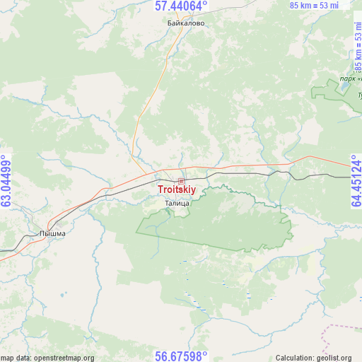
Troitskiy GPS coordinates[2]
57° 3' 37.008" North, 63° 44' 53.196" East
| Map corner | latitude | longitude |
|---|---|---|
| Upper-left | 57.44064°, | 63.04499° |
| Center: | 57.06028°, | 63.74811° |
| Lower-right: | 56.67598°, | 64.45124° |
| Map W x H: | 85×85 km | = 52.8×52.8mi |
| max Lat: | 73.50819° ⇑22.3% North |
| Troitskiy: | 57.06028° |
| min Lat: | ⇓77.7% South 41.28413° |
| min Long | Troitskiy | max Long |
| -179.12198° | 63.74811° | 179.35046° |
| W 75.2%⇐ | ⇒24.8% E |
Elevation
Elevation of Troitskiy is 78 m = 256 ft, and this is 124.6 m = 409 ft below average elevation for this country.
| Max E: |
2518 m = 8261 ft | 77.8% |
| Avg. | 202.6 m = 665 ft | |
| Troitskiy | 78 m = 256 ft | |
Min E: |
-28 m = -92 ft | 22.2% |
See also: Russia elevation on elevation.city.
Geographical zone
Troitskiy is located in North temperate zone (between Tropic of Cancer and the Arctic Circle). Distance of this North polar circle is 1056.7 km =656.6 mi to North.| Distance of | km | miles | from Troitskiy |
|---|---|---|---|
| North Pole | 3662.6 | 2275.8 | to North |
| Arctic Circle | 1056.7 | 656.6 | to North |
| Tropic Cancer | 3738.6 | 2323.1 | to South |
| Equator | 6344.5 | 3942.3 | to South |


Nearby cities:
15 places around Troitskiy: (largest is in red/bold)
• Barannikova
64.8 km =40.3 mi,  244°
244°
• Baykalovo
37.6 km =23.4 mi,  1°
1°
• Butka
38.1 km =23.7 mi,  176°
176°
• Cheremysh
47.7 km =29.6 mi, 241°
• Galkinskoye
64.2 km =39.9 mi,  254°
254°
• Kamyshlov
67.4 km =41.9 mi, 248°
• Kvashninskoye
64.3 km =40 mi,  273°
273°
• Lugovskoy
48.6 km =30.2 mi,  103°
103°
• Nikol’skoye
54.4 km =33.8 mi, 243°
• Pyshma
32.4 km =20.1 mi, 248°
• Skatinskoye
65.6 km =40.8 mi, 235°
• Talitsa
5.6 km =3.5 mi,  189°
189°
• Tugulym
54.1 km =33.6 mi,  90°
90°
• Yertarskiy
45 km =28 mi,  131°
131°
• Yushala
31 km =19.3 mi, 86°
Sources, notices
• [Note1] Compared only with cities in Russia existing in our database
• [Src1] Map data: © OpenStreetMap contributors (CC-BY-SA)
• [Src2] Other city data from geonames.org with taken over terms of usage.
• [Src3] Geographical zone / Annual Mean Temperature by Robert A. Rohde @ Wikipedia
