Saranpaul’ geodata
Saranpaul’ (Khanty-Mansia) is a populated place; located in Russia in Asia/Yekaterinburg (GMT+5) time zone. With population of 2,985 people, there are 3785 cities with bigger population in this country. Compared to other cities in Russia, 97.1% of cities are located further ↓South; 73.1% of cities are located further ←West and 89% of cities have higher elevation than Saranpaul’. Note1


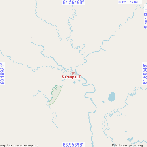
Saranpaul’ GPS coordinates[2]
64° 15' 39.672" North, 60° 54' 8.388" East
| Map corner | latitude | longitude |
|---|---|---|
| Upper-left | 64.56468°, | 60.19921° |
| Center: | 64.26102°, | 60.90233° |
| Lower-right: | 63.95398°, | 61.60546° |
| Map W x H: | 67.9×67.9 km | = 42.2×42.2mi |
| max Lat: | 73.50819° ⇑2.9% North |
| Saranpaul’: | 64.26102° |
| min Lat: | ⇓97.1% South 41.28413° |
| min Long | Saranpaul’ | max Long |
| -179.12198° | 60.90233° | 179.35046° |
| W 73.1%⇐ | ⇒26.9% E |
Elevation
Elevation of Saranpaul’ is 32 m = 105 ft, and this is 170.6 m = 560 ft below average elevation for this country.
| Max E: |
2518 m = 8261 ft | 89% |
| Avg. | 202.6 m = 665 ft | |
| Saranpaul’ | 32 m = 105 ft | |
Min E: |
-28 m = -92 ft | 11% |
See also: Russia elevation on elevation.city.
Geographical zone
Saranpaul’ is located in North temperate zone (between Tropic of Cancer and the Arctic Circle). Distance of this North polar circle is 256 km =159.1 mi to North.| Distance of | km | miles | from Saranpaul’ |
|---|---|---|---|
| North Pole | 2861.9 | 1778.3 | to North |
| Arctic Circle | 256 | 159.1 | to North |
| Tropic Cancer | 4539.2 | 2820.5 | to South |
| Equator | 7145.2 | 4439.8 | to South |


Nearby cities:
15 places around Saranpaul’: (largest is in red/bold)
• Agirish
280.8 km =174.5 mi,  157°
157°
• Igrim
209.9 km =130.4 mi,  124°
124°
• Inta
199.9 km =124.2 mi,  350°
350°
• Khulimsunt
159.7 km =99.2 mi,  166°
166°
• Kozhva
206 km =128 mi,  297°
297°
• Muzhi
219.8 km =136.6 mi,  54°
54°
• Parma
244.5 km =151.9 mi,  322°
322°
• Pechora
200.6 km =124.6 mi, 299°
• Puteyets
207.3 km =128.8 mi, 299°
• Sovetskiy
349.9 km =217.4 mi, 157°
• Synya
183.3 km =113.9 mi,  312°
312°
• Usinsk
249 km =154.7 mi, 320°
• Verkhnyaya Inta
193.3 km =120.1 mi, 351°
• Vuktyl
180.4 km =112.1 mi,  255°
255°
• Yugorsk
350.3 km =217.7 mi, 159°
Sources, notices
• [Note1] Compared only with cities in Russia existing in our database
• [Src1] Map data: © OpenStreetMap contributors (CC-BY-SA)
• [Src2] Other city data from geonames.org with taken over terms of usage.
• [Src3] Geographical zone / Annual Mean Temperature by Robert A. Rohde @ Wikipedia
