Muzhi geodata
Muzhi (Yamalo-Nenets) is a populated place; located in Russia in Asia/Yekaterinburg (GMT+5) time zone. With population of 3,209 people, there are 3602 cities with bigger population in this country. Compared to other cities in Russia, 97.7% of cities are located further ↓South; 75.7% of cities are located further ←West and 98.8% of cities have higher elevation than Muzhi. Note1


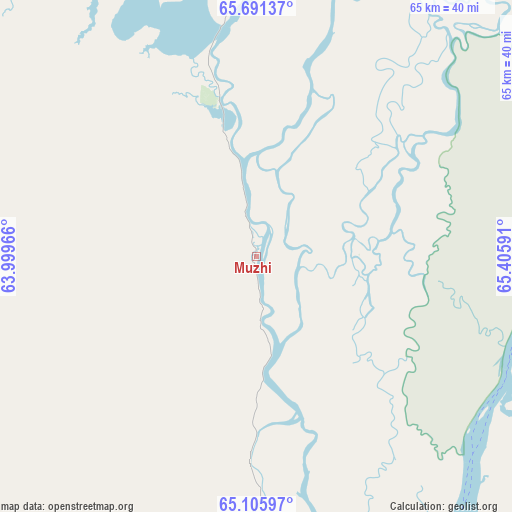
Muzhi GPS coordinates[2]
65° 24' 1.08" North, 64° 42' 10.008" East
| Map corner | latitude | longitude |
|---|---|---|
| Upper-left | 65.69137°, | 63.99966° |
| Center: | 65.4003°, | 64.70278° |
| Lower-right: | 65.10597°, | 65.40591° |
| Map W x H: | 65.1×65.1 km | = 40.5×40.5mi |
| max Lat: | 73.50819° ⇑2.3% North |
| Muzhi: | 65.4003° |
| min Lat: | ⇓97.7% South 41.28413° |
| min Long | Muzhi | max Long |
| -179.12198° | 64.70278° | 179.35046° |
| W 75.7%⇐ | ⇒24.3% E |
Elevation
Elevation of Muzhi is 1 m = 3 ft, and this is 201.6 m = 661 ft below average elevation for this country.
| Max E: |
2518 m = 8261 ft | 98.8% |
| Avg. | 202.6 m = 665 ft | |
| Muzhi | 1 m = 3 ft | |
Min E: |
-28 m = -92 ft | 1.2% |
See also: Russia elevation on elevation.city.
Geographical zone
Muzhi is located in North temperate zone (between Tropic of Cancer and the Arctic Circle). Distance of this North polar circle is 129.3 km =80.3 mi to North.| Distance of | km | miles | from Muzhi |
|---|---|---|---|
| North Pole | 2735.2 | 1699.6 | to North |
| Arctic Circle | 129.3 | 80.3 | to North |
| Tropic Cancer | 4665.9 | 2899.3 | to South |
| Equator | 7271.8 | 4518.5 | to South |


Nearby cities:
15 places around Muzhi: (largest is in red/bold)
• Aksarka
190.4 km =118.3 mi,  47°
47°
• Beloyarskiy
210 km =130.5 mi,  153°
153°
• Berëzovo
163.4 km =101.5 mi,  174°
174°
• Igrim
246.1 km =152.9 mi,  183°
183°
• Kharp
163.5 km =101.6 mi,  17°
17°
• Labytnangi
159.8 km =99.3 mi,  29°
29°
• Promyshlennyy
245.2 km =152.4 mi,  351°
351°
• Salekhard
152.2 km =94.6 mi, 34°
• Saranpaul’
219.8 km =136.6 mi,  234°
234°
• Sovetskiy
232 km =144.2 mi,  356°
356°
• Tsementnozavodskiy
249.2 km =154.8 mi, 353°
• Vorgashor
246.1 km =152.9 mi, 350°
• Vorkuta
235.1 km =146.1 mi, 352°
• Yeletskiy
184.3 km =114.5 mi, 353°
• Zapolyarnyy
236.9 km =147.2 mi, 349°
Sources, notices
• [Note1] Compared only with cities in Russia existing in our database
• [Src1] Map data: © OpenStreetMap contributors (CC-BY-SA)
• [Src2] Other city data from geonames.org with taken over terms of usage.
• [Src3] Geographical zone / Annual Mean Temperature by Robert A. Rohde @ Wikipedia
