Mendeleyevo geodata
Mendeleyevo (Tyumen’ Oblast) is a populated place; located in Russia in Asia/Yekaterinburg (GMT+5) time zone. With population of 4,270 people, there are 2966 cities with bigger population in this country. Compared to other cities in Russia, 83.4% of cities are located further ↓South; 76.8% of cities are located further ←West and 86.7% of cities have higher elevation than Mendeleyevo. Note1


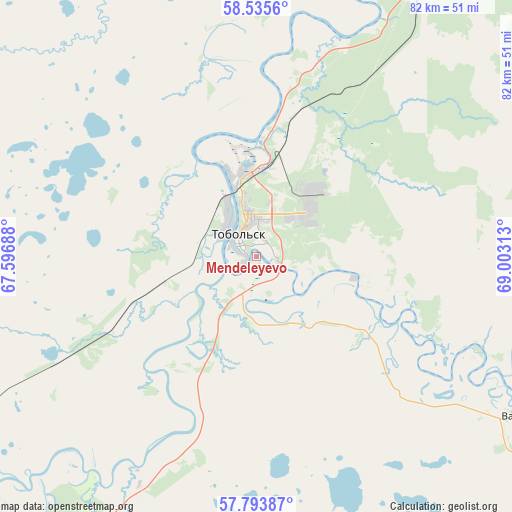
Mendeleyevo GPS coordinates[2]
58° 10' 0.012" North, 68° 18' 0" East
| Map corner | latitude | longitude |
|---|---|---|
| Upper-left | 58.5356°, | 67.59688° |
| Center: | 58.16667°, | 68.3° |
| Lower-right: | 57.79387°, | 69.00313° |
| Map W x H: | 82.5×82.5 km | = 51.3×51.3mi |
| max Lat: | 73.50819° ⇑16.6% North |
| Mendeleyevo: | 58.16667° |
| min Lat: | ⇓83.4% South 41.28413° |
| min Long | Mendeleyevo | max Long |
| -179.12198° | 68.3° | 179.35046° |
| W 76.8%⇐ | ⇒23.2% E |
Elevation
Elevation of Mendeleyevo is 41 m = 135 ft, and this is 161.6 m = 530 ft below average elevation for this country.
| Max E: |
2518 m = 8261 ft | 86.7% |
| Avg. | 202.6 m = 665 ft | |
| Mendeleyevo | 41 m = 135 ft | |
Min E: |
-28 m = -92 ft | 13.3% |
See also: Russia elevation on elevation.city.
Geographical zone
Mendeleyevo is located in North temperate zone (between Tropic of Cancer and the Arctic Circle). Distance of this North polar circle is 933.6 km =580.1 mi to North.| Distance of | km | miles | from Mendeleyevo |
|---|---|---|---|
| North Pole | 3539.5 | 2199.3 | to North |
| Arctic Circle | 933.6 | 580.1 | to North |
| Tropic Cancer | 3861.6 | 2399.5 | to South |
| Equator | 6467.5 | 4018.7 | to South |


Nearby cities:
15 places around Mendeleyevo: (largest is in red/bold)
• Abalak
17.8 km =11.1 mi,  103°
103°
• Aromashevo
146.7 km =91.2 mi,  172°
172°
• Irtyshskiy
20.9 km =13 mi,  332°
332°
• Kondinskoye
172.5 km =107.2 mi,  342°
342°
• Kuminskiy
115.2 km =71.6 mi,  298°
298°
• Nizhnyaya Tavda
137.1 km =85.2 mi,  246°
246°
• Sumkino
6.4 km =4 mi, 166°
• Tobol’sk
4.4 km =2.7 mi,  322°
322°
• Turtas
98.5 km =61.2 mi,  29°
29°
• Uspenka
161.6 km =100.4 mi,  159°
159°
• Ust’-Ishim
177.2 km =110.1 mi,  107°
107°
• Uvat
113.7 km =70.6 mi,  17°
17°
• Vagay
49.5 km =30.8 mi,  121°
121°
• Yarkovo
112.1 km =69.7 mi,  220°
220°
• Yurginskoye
159.4 km =99 mi,  199°
199°
Sources, notices
• [Note1] Compared only with cities in Russia existing in our database
• [Src1] Map data: © OpenStreetMap contributors (CC-BY-SA)
• [Src2] Other city data from geonames.org with taken over terms of usage.
• [Src3] Geographical zone / Annual Mean Temperature by Robert A. Rohde @ Wikipedia
