Karagayla geodata
Karagayla (Kemerovo Oblast) is a populated place; located in Russia in Asia/Novokuznetsk (GMT+7) time zone. With population of 4,326 people, there are 2942 cities with bigger population in this country. Compared to other cities in Russia, 53.7% of cities are located further ↑North; 84.3% of cities are located further ←West and 82.6% of cities have lower elevation than Karagayla. Note1


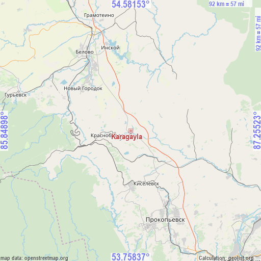
Karagayla GPS coordinates[2]
54° 10' 19.2" North, 86° 33' 7.56" East
| Map corner | latitude | longitude |
|---|---|---|
| Upper-left | 54.58153°, | 85.84898° |
| Center: | 54.172°, | 86.5521° |
| Lower-right: | 53.75837°, | 87.25523° |
| Map W x H: | 91.5×91.5 km | = 56.9×56.9mi |
| max Lat: | 73.50819° ⇑53.7% North |
| Karagayla: | 54.172° |
| min Lat: | ⇓46.3% South 41.28413° |
| min Long | Karagayla | max Long |
| -179.12198° | 86.5521° | 179.35046° |
| W 84.3%⇐ | ⇒15.7% E |
Elevation
Elevation of Karagayla is 280 m = 919 ft, and this is 77.4 m = 254 ft above average elevation for this country.
| Max E: |
2518 m = 8261 ft | 17.4% |
| Karagayla | 280 m 919 ft | |
| Avg. | 202.6 m = 665 ft | |
Min E: |
-28 m = -92 ft | 82.6% |
See also: Russia elevation on elevation.city.
Geographical zone
Karagayla is located in North temperate zone (between Tropic of Cancer and the Arctic Circle). Distance of this North polar circle is 1377.8 km =856.1 mi to North.| Distance of | km | miles | from Karagayla |
|---|---|---|---|
| North Pole | 3983.7 | 2475.4 | to North |
| Arctic Circle | 1377.8 | 856.1 | to North |
| Tropic Cancer | 3417.4 | 2123.5 | to South |
| Equator | 6023.4 | 3742.8 | to South |


Nearby cities:
15 places around Karagayla: (largest is in red/bold)
• Artyshta
17.9 km =11.1 mi,  251°
251°
• Bachatskiy
30.6 km =19 mi,  295°
295°
• Belovo
31.8 km =19.8 mi,  328°
328°
• Gramoteino
42 km =26.1 mi,  344°
344°
• Gur’yevsk
42.1 km =26.2 mi,  287°
287°
• Inskoy
29.6 km =18.4 mi,  345°
345°
• Kiselëvsk
21.5 km =13.4 mi,  160°
160°
• Krasnobrodskiy
6.9 km =4.3 mi,  257°
257°
• Krasnogorskiy
45.3 km =28.1 mi, 337°
• Polysayevo
51.7 km =32.1 mi, 337°
• Prokop’yevsk
31.5 km =19.6 mi, 159°
• Salair
49.5 km =30.8 mi,  277°
277°
• Starobachaty
23.8 km =14.8 mi, 289°
• Staropesterevo
37.6 km =23.4 mi, 345°
• Trudarmeyskiy
10.3 km =6.4 mi,  244°
244°
Sources, notices
• [Note1] Compared only with cities in Russia existing in our database
• [Src1] Map data: © OpenStreetMap contributors (CC-BY-SA)
• [Src2] Other city data from geonames.org with taken over terms of usage.
• [Src3] Geographical zone / Annual Mean Temperature by Robert A. Rohde @ Wikipedia
