Borodino geodata
Borodino (Krasnoyarskiy) is a populated place; located in Russia in Asia/Krasnoyarsk (GMT+7) time zone. With population of 19,602 people, there are 885 cities with bigger population in this country. Compared to other cities in Russia, 65.2% of cities are located further ↓South; 87.2% of cities are located further ←West and 85.7% of cities have lower elevation than Borodino. Note1


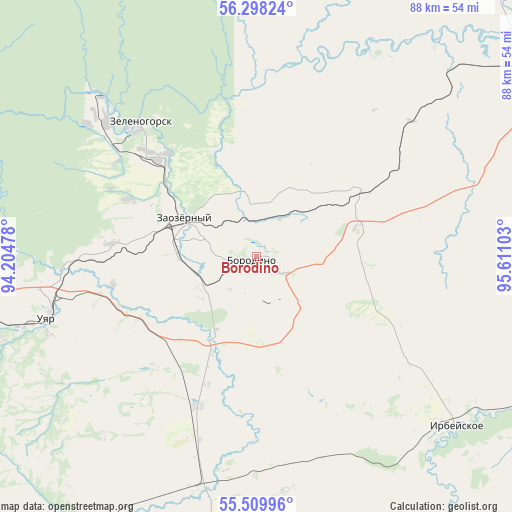
Borodino GPS coordinates[2]
55° 54' 21.96" North, 94° 54' 28.44" East
| Map corner | latitude | longitude |
|---|---|---|
| Upper-left | 56.29824°, | 94.20478° |
| Center: | 55.9061°, | 94.9079° |
| Lower-right: | 55.50996°, | 95.61103° |
| Map W x H: | 87.6×87.6 km | = 54.4×54.4mi |
| max Lat: | 73.50819° ⇑34.8% North |
| Borodino: | 55.9061° |
| min Lat: | ⇓65.2% South 41.28413° |
| min Long | Borodino | max Long |
| -179.12198° | 94.9079° | 179.35046° |
| W 87.2%⇐ | ⇒12.8% E |
Elevation
Elevation of Borodino is 337 m = 1106 ft, and this is 134.4 m = 441 ft above average elevation for this country.
| Max E: |
2518 m = 8261 ft | 14.3% |
| Borodino | 337 m 1106 ft | |
| Avg. | 202.6 m = 665 ft | |
Min E: |
-28 m = -92 ft | 85.7% |
See also: Russia elevation on elevation.city.
Geographical zone
Borodino is located in North temperate zone (between Tropic of Cancer and the Arctic Circle). Distance of this North polar circle is 1185 km =736.3 mi to North.| Distance of | km | miles | from Borodino |
|---|---|---|---|
| North Pole | 3790.9 | 2355.6 | to North |
| Arctic Circle | 1185 | 736.3 | to North |
| Tropic Cancer | 3610.3 | 2243.3 | to South |
| Equator | 6216.2 | 3862.6 | to South |


Nearby cities:
15 places around Borodino: (largest is in red/bold)
• Aginskoye
72 km =44.7 mi,  180°
180°
• Dzerzhinskoye
105.1 km =65.3 mi,  10°
10°
• Filimonovo
47.5 km =29.5 mi,  46°
46°
• Ilanskiy
80.5 km =50 mi,  63°
63°
• Irbeyskoye
45.1 km =28 mi,  131°
131°
• Irsha
7.1 km =4.4 mi,  289°
289°
• Kansk
60.1 km =37.3 mi, 56°
• Nizhniy Ingash
106.3 km =66.1 mi,  72°
72°
• Partizanskoye
55.8 km =34.7 mi,  215°
215°
• Shalinskoye
74.7 km =46.4 mi,  253°
253°
• Sosnovoborsk
100.4 km =62.4 mi,  283°
283°
• Ural
9.6 km =6 mi,  269°
269°
• Uyar
37.9 km =23.5 mi, 253°
• Zelenogorsk
29.9 km =18.6 mi,  320°
320°
• Zheleznogorsk
93.6 km =58.2 mi, 294°
Sources, notices
• [Note1] Compared only with cities in Russia existing in our database
• [Src1] Map data: © OpenStreetMap contributors (CC-BY-SA)
• [Src2] Other city data from geonames.org with taken over terms of usage.
• [Src3] Geographical zone / Annual Mean Temperature by Robert A. Rohde @ Wikipedia
