Qurayyat geodata
Qurayyat (Al Jawf) is a populated place; located in Saudi Arabia in Asia/Riyadh (GMT+3) time zone. With population of 102,903 people, there are 23 cities with bigger population in this country. Compared to other cities in Saudi Arabia, 99% of cities are located further ↓South; 95.9% of cities are located further →East and 53.6% of cities have lower elevation than Qurayyat. Note1


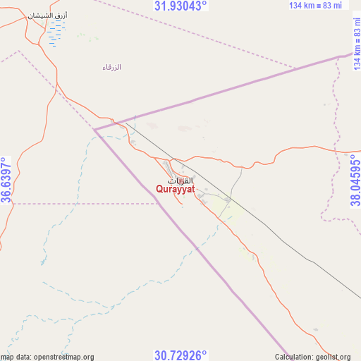
Qurayyat GPS coordinates[2]
31° 19' 54.336" North, 37° 20' 34.152" East
| Map corner | latitude | longitude |
|---|---|---|
| Upper-left | 31.93043°, | 36.6397° |
| Center: | 31.33176°, | 37.34282° |
| Lower-right: | 30.72926°, | 38.04595° |
| Map W x H: | 133.6×133.6 km | = 83×83mi |
| max Lat: | 31.67252° ⇑1% North |
| Qurayyat: | 31.33176° |
| min Lat: | ⇓99% South 16.57946° |
| min Long | Qurayyat | max Long |
| 35.69014° | 37.34282° | 54.09599° |
| W 4.1%⇐ | ⇒95.9% E |
Elevation
Elevation of Qurayyat is 498 m = 1634 ft, and this is 23.4 m = 77 ft below average elevation for this country.
| Max E: |
2385 m = 7825 ft | 46.4% |
| Avg. | 521.4 m = 1711 ft | |
| Qurayyat | 498 m = 1634 ft | |
Min E: |
3 m = 10 ft | 53.6% |
See also: Qurayyat elevation on elevation.city.
Geographical zone
Qurayyat is located in North temperate zone (between Tropic of Cancer and the Arctic Circle). Distance of this Northern Tropic circle is 877.8 km =545.4 mi to South.| Distance of | km | miles | from Qurayyat |
|---|---|---|---|
| North Pole | 6523.3 | 4053.4 | to North |
| Arctic Circle | 3917.4 | 2434.2 | to North |
| Tropic Cancer | 877.8 | 545.4 | to South |
| Equator | 3483.8 | 2164.7 | to South |


Nearby cities:
6 places around Qurayyat: (largest is in red/bold)
• Arar
353.8 km =219.8 mi,  96°
96°
• Sakakah
313 km =194.5 mi,  118°
118°
• Tabuk
334.4 km =207.8 mi,  192°
192°
• Turaif
130.8 km =81.3 mi,  73°
73°
• Şuwayr
321 km =199.5 mi,  114°
114°
• Ţubarjal
124.5 km =77.4 mi,  137°
137°
Sources, notices
• [Note1] Compared only with cities in Saudi Arabia existing in our database
• [Src1] Map data: © OpenStreetMap contributors (CC-BY-SA)
• [Src2] Other city data from geonames.org with taken over terms of usage.
• [Src3] Geographical zone / Annual Mean Temperature by Robert A. Rohde @ Wikipedia
