Arar geodata
Arar (Northern Borders) is a seat of a first-order administrative division; located in Saudi Arabia in Asia/Riyadh (GMT+3) time zone. With population of 148,540 people, there are 20 cities with bigger population in this country. Compared to other cities in Saudi Arabia, 97.9% of cities are located further ↓South; 78.4% of cities are located further →East and 55.7% of cities have lower elevation than Arar. Note1


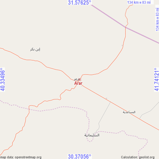
Arar GPS coordinates[2]
30° 58' 31.116" North, 41° 2' 17.088" East
| Map corner | latitude | longitude |
|---|---|---|
| Upper-left | 31.57625°, | 40.33496° |
| Center: | 30.97531°, | 41.03808° |
| Lower-right: | 30.37056°, | 41.74121° |
| Map W x H: | 134.1×134.1 km | = 83.3×83.3mi |
| max Lat: | 31.67252° ⇑2.1% North |
| Arar: | 30.97531° |
| min Lat: | ⇓97.9% South 16.57946° |
| min Long | Arar | max Long |
| 35.69014° | 41.03808° | 54.09599° |
| W 21.6%⇐ | ⇒78.4% E |
Elevation
Elevation of Arar is 555 m = 1821 ft, and this is 33.6 m = 110 ft above average elevation for this country.
| Max E: |
2385 m = 7825 ft | 44.3% |
| Arar | 555 m 1821 ft | |
| Avg. | 521.4 m = 1711 ft | |
Min E: |
3 m = 10 ft | 55.7% |
See also: Arar elevation on elevation.city.
Geographical zone
Arar is located in North temperate zone (between Tropic of Cancer and the Arctic Circle). Distance of this Northern Tropic circle is 838.2 km =520.8 mi to South.| Distance of | km | miles | from Arar |
|---|---|---|---|
| North Pole | 6562.9 | 4078 | to North |
| Arctic Circle | 3957 | 2458.8 | to North |
| Tropic Cancer | 838.2 | 520.8 | to South |
| Equator | 3444.1 | 2140.1 | to South |


Nearby cities:
6 places around Arar: (largest is in red/bold)
• Ha'il
389.2 km =241.8 mi,  170°
170°
• Qurayyat
353.8 km =219.8 mi,  276°
276°
• Sakakah
137.3 km =85.3 mi,  215°
215°
• Turaif
238.5 km =148.2 mi,  288°
288°
• Şuwayr
113.9 km =70.8 mi,  213°
213°
• Ţubarjal
274.8 km =170.8 mi,  258°
258°
Sources, notices
• [Note1] Compared only with cities in Saudi Arabia existing in our database
• [Src1] Map data: © OpenStreetMap contributors (CC-BY-SA)
• [Src2] Other city data from geonames.org with taken over terms of usage.
• [Src3] Geographical zone / Annual Mean Temperature by Robert A. Rohde @ Wikipedia
