Velanda geodata
Velanda (Örebro) is a populated place; located in Sweden in Europe/Stockholm (GMT+2) time zone. With population of 563 people, there are 1215 cities with bigger population in this country. Compared to other cities in Sweden, 56.8% of cities are located further ↓South; 50.3% of cities are located further ←West and 54.7% of cities have higher elevation than Velanda. Note1


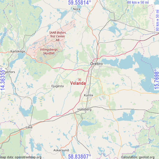
Velanda GPS coordinates[2]
59° 12' 0" North, 15° 4' 0.012" East
| Map corner | latitude | longitude |
|---|---|---|
| Upper-left | 59.55814°, | 14.36355° |
| Center: | 59.2°, | 15.06667° |
| Lower-right: | 58.83807°, | 15.7698° |
| Map W x H: | 80.1×80.1 km | = 49.8×49.8mi |
| max Lat: | 67.85572° ⇑43.2% North |
| Velanda: | 59.2° |
| min Lat: | ⇓56.8% South 55.34337° |
| min Long | Velanda | max Long |
| 11.1712° | 15.06667° | 24.13676° |
| W 50.3%⇐ | ⇒49.7% E |
Elevation
Elevation of Velanda is 43 m = 141 ft, and this is 39.6 m = 130 ft below average elevation for this country.
| Max E: |
663 m = 2175 ft | 54.7% |
| Avg. | 82.6 m = 271 ft | |
| Velanda | 43 m = 141 ft | |
Min E: |
-1 m = -3 ft | 45.3% |
See also: Sweden elevation on elevation.city.
Geographical zone
Velanda is located in North temperate zone (between Tropic of Cancer and the Arctic Circle). Distance of this North polar circle is 818.8 km =508.8 mi to North.| Distance of | km | miles | from Velanda |
|---|---|---|---|
| North Pole | 3424.6 | 2127.9 | to North |
| Arctic Circle | 818.8 | 508.8 | to North |
| Tropic Cancer | 3976.5 | 2470.9 | to South |
| Equator | 6582.4 | 4090.1 | to South |


Nearby cities:
15 places around Velanda: (largest is in red/bold)
• Ekeby-Almby
16.4 km =10.2 mi,  65°
65°
• Fjugesta
11.5 km =7.1 mi,  255°
255°
• Garphyttan
13.5 km =8.4 mi,  329°
329°
• Hallsberg
15.3 km =9.5 mi,  170°
170°
• Hovsta
18.7 km =11.6 mi,  27°
27°
• Hällabrottet
12 km =7.5 mi,  140°
140°
• Kumla
9.2 km =5.7 mi,  151°
151°
• Latorpsbruk
9.4 km =5.8 mi, 329°
• Mosås
3.8 km =2.4 mi,  90°
90°
• Norra Bro
10.6 km =6.6 mi,  79°
79°
• Sköllersta
17 km =10.6 mi,  114°
114°
• Vintrosa
8.7 km =5.4 mi,  309°
309°
• Åbytorp
8.3 km =5.2 mi,  177°
177°
• Örebro
11.5 km =7.1 mi,  43°
43°
• Östansjö
17.3 km =10.7 mi,  195°
195°
Sources, notices
• [Note1] Compared only with cities in Sweden existing in our database
• [Src1] Map data: © OpenStreetMap contributors (CC-BY-SA)
• [Src2] Other city data from geonames.org with taken over terms of usage.
• [Src3] Geographical zone / Annual Mean Temperature by Robert A. Rohde @ Wikipedia
