Garphyttan geodata
Garphyttan (Örebro) is a populated place; located in Sweden in Europe/Stockholm (GMT+2) time zone. With population of 1,613 people, there are 615 cities with bigger population in this country. Compared to other cities in Sweden, 60% of cities are located further ↓South; 52% of cities are located further →East and 70.3% of cities have lower elevation than Garphyttan. Note1


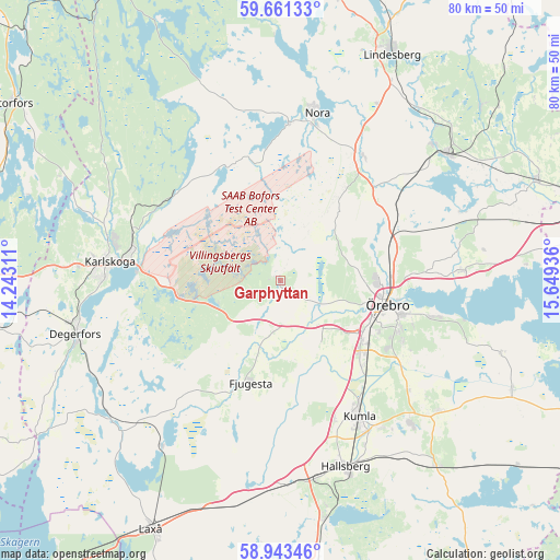
Garphyttan GPS coordinates[2]
59° 18' 15.444" North, 14° 56' 46.428" East
| Map corner | latitude | longitude |
|---|---|---|
| Upper-left | 59.66133°, | 14.24311° |
| Center: | 59.30429°, | 14.94623° |
| Lower-right: | 58.94346°, | 15.64936° |
| Map W x H: | 79.8×79.8 km | = 49.6×49.6mi |
| max Lat: | 67.85572° ⇑40% North |
| Garphyttan: | 59.30429° |
| min Lat: | ⇓60% South 55.34337° |
| min Long | Garphyttan | max Long |
| 11.1712° | 14.94623° | 24.13676° |
| W 48%⇐ | ⇒52% E |
Elevation
Elevation of Garphyttan is 99 m = 325 ft, and this is 16.4 m = 54 ft above average elevation for this country.
| Max E: |
663 m = 2175 ft | 29.7% |
| Garphyttan | 99 m 325 ft | |
| Avg. | 82.6 m = 271 ft | |
Min E: |
-1 m = -3 ft | 70.3% |
See also: Sweden elevation on elevation.city.
Geographical zone
Garphyttan is located in North temperate zone (between Tropic of Cancer and the Arctic Circle). Distance of this North polar circle is 807.2 km =501.6 mi to North.| Distance of | km | miles | from Garphyttan |
|---|---|---|---|
| North Pole | 3413 | 2120.7 | to North |
| Arctic Circle | 807.2 | 501.6 | to North |
| Tropic Cancer | 3988.1 | 2478.1 | to South |
| Equator | 6594 | 4097.3 | to South |


Nearby cities:
15 places around Garphyttan: (largest is in red/bold)
• Ekeby-Almby
22.3 km =13.9 mi,  102°
102°
• Fjugesta
15.1 km =9.4 mi,  196°
196°
• Gyttorp
22.3 km =13.9 mi,  2°
2°
• Hovsta
16.2 km =10.1 mi,  71°
71°
• Karlskoga
24.1 km =15 mi,  275°
275°
• Kumla
22.6 km =14 mi,  150°
150°
• Latorpsbruk
4.1 km =2.5 mi, 149°
• Mosås
15.7 km =9.8 mi,  137°
137°
• Mullhyttan
22.8 km =14.2 mi,  221°
221°
• Norra Bro
19.8 km =12.3 mi,  119°
119°
• Velanda
13.5 km =8.4 mi, 149°
• Vintrosa
6 km =3.7 mi,  177°
177°
• Åbytorp
21.2 km =13.2 mi,  159°
159°
• Ölmbrotorp
19.4 km =12.1 mi,  59°
59°
• Örebro
15.2 km =9.4 mi, 102°
Sources, notices
• [Note1] Compared only with cities in Sweden existing in our database
• [Src1] Map data: © OpenStreetMap contributors (CC-BY-SA)
• [Src2] Other city data from geonames.org with taken over terms of usage.
• [Src3] Geographical zone / Annual Mean Temperature by Robert A. Rohde @ Wikipedia
