Skogsby geodata
Skogsby (Kalmar) is a populated place; located in Sweden in Europe/Stockholm (GMT+2) time zone. With population of 948 people, there are 850 cities with bigger population in this country. Compared to other cities in Sweden, 82.1% of cities are located further ↑North; 68.6% of cities are located further ←West and 54.7% of cities have higher elevation than Skogsby. Note1


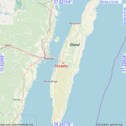
Skogsby GPS coordinates[2]
56° 38' 11.148" North, 16° 31' 23.556" East
| Map corner | latitude | longitude |
|---|---|---|
| Upper-left | 57.02114°, | 15.82009° |
| Center: | 56.63643°, | 16.52321° |
| Lower-right: | 56.24776°, | 17.22634° |
| Map W x H: | 86×86 km | = 53.4×53.4mi |
| max Lat: | 67.85572° ⇑82.1% North |
| Skogsby: | 56.63643° |
| min Lat: | ⇓17.9% South 55.34337° |
| min Long | Skogsby | max Long |
| 11.1712° | 16.52321° | 24.13676° |
| W 68.6%⇐ | ⇒31.4% E |
Elevation
Elevation of Skogsby is 43 m = 141 ft, and this is 39.6 m = 130 ft below average elevation for this country.
| Max E: |
663 m = 2175 ft | 54.7% |
| Avg. | 82.6 m = 271 ft | |
| Skogsby | 43 m = 141 ft | |
Min E: |
-1 m = -3 ft | 45.3% |
See also: Sweden elevation on elevation.city.
Geographical zone
Skogsby is located in North temperate zone (between Tropic of Cancer and the Arctic Circle). Distance of this North polar circle is 1103.8 km =685.9 mi to North.| Distance of | km | miles | from Skogsby |
|---|---|---|---|
| North Pole | 3709.7 | 2305.1 | to North |
| Arctic Circle | 1103.8 | 685.9 | to North |
| Tropic Cancer | 3691.5 | 2293.8 | to South |
| Equator | 6297.4 | 3913 | to South |


Nearby cities:
15 places around Skogsby: (largest is in red/bold)
• Algutsrum
5.2 km =3.2 mi,  2°
2°
• Borgholm
28.2 km =17.5 mi,  16°
16°
• Färjestaden
3.7 km =2.3 mi,  294°
294°
• Hagby
22.6 km =14 mi,  245°
245°
• Kalmar
10.3 km =6.4 mi, 285°
• Lindsdal
17.4 km =10.8 mi,  308°
308°
• Ljungbyholm
21.8 km =13.5 mi,  269°
269°
• Mörbylånga
15.2 km =9.4 mi,  215°
215°
• Rinkabyholm
15.8 km =9.8 mi,  275°
275°
• Rockneby
21.2 km =13.2 mi,  330°
330°
• Smedby
17.6 km =10.9 mi, 283°
• Söderåkra
34.8 km =21.6 mi,  233°
233°
• Södra Sandby
9.6 km =6 mi,  143°
143°
• Trekanten
25.8 km =16 mi, 285°
• Vassmolösa
22.2 km =13.8 mi,  259°
259°
Sources, notices
• [Note1] Compared only with cities in Sweden existing in our database
• [Src1] Map data: © OpenStreetMap contributors (CC-BY-SA)
• [Src2] Other city data from geonames.org with taken over terms of usage.
• [Src3] Geographical zone / Annual Mean Temperature by Robert A. Rohde @ Wikipedia
