Kläppa geodata
Kläppa (Halland) is a populated place; located in Sweden in Europe/Stockholm (GMT+2) time zone. With population of 625 people, there are 1150 cities with bigger population in this country. Compared to other cities in Sweden, 73.9% of cities are located further ↑North; 92.5% of cities are located further →East and 61.1% of cities have higher elevation than Kläppa. Note1


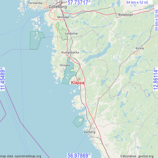
Kläppa GPS coordinates[2]
57° 21' 35.604" North, 12° 9' 28.836" East
| Map corner | latitude | longitude |
|---|---|---|
| Upper-left | 57.73717°, | 11.45489° |
| Center: | 57.35989°, | 12.15801° |
| Lower-right: | 56.97869°, | 12.86114° |
| Map W x H: | 84.3×84.3 km | = 52.4×52.4mi |
| max Lat: | 67.85572° ⇑73.9% North |
| Kläppa: | 57.35989° |
| min Lat: | ⇓26.1% South 55.34337° |
| min Long | Kläppa | max Long |
| 11.1712° | 12.15801° | 24.13676° |
| W 7.5%⇐ | ⇒92.5% E |
Elevation
Elevation of Kläppa is 34 m = 112 ft, and this is 48.6 m = 159 ft below average elevation for this country.
| Max E: |
663 m = 2175 ft | 61.1% |
| Avg. | 82.6 m = 271 ft | |
| Kläppa | 34 m = 112 ft | |
Min E: |
-1 m = -3 ft | 38.9% |
See also: Sweden elevation on elevation.city.
Geographical zone
Kläppa is located in North temperate zone (between Tropic of Cancer and the Arctic Circle). Distance of this North polar circle is 1023.4 km =635.9 mi to North.| Distance of | km | miles | from Kläppa |
|---|---|---|---|
| North Pole | 3629.2 | 2255.1 | to North |
| Arctic Circle | 1023.4 | 635.9 | to North |
| Tropic Cancer | 3771.9 | 2343.7 | to South |
| Equator | 6377.8 | 3963 | to South |


Nearby cities:
15 places around Kläppa: (largest is in red/bold)
• Bua
13.7 km =8.5 mi,  189°
189°
• Fjärås kyrkby
11.1 km =6.9 mi,  5°
5°
• Frillesås
4.8 km =3 mi,  173°
173°
• Horred
19.2 km =11.9 mi,  91°
91°
• Kungsbacka
15 km =9.3 mi,  340°
340°
• Onsala
10.6 km =6.6 mi,  313°
313°
• Särö
21.1 km =13.1 mi,  320°
320°
• Tångaberg
21.1 km =13.1 mi, 168°
• Vallda
16.1 km =10 mi, 324°
• Veddige
14.8 km =9.2 mi,  134°
134°
• Väröbacka
12.3 km =7.6 mi, 172°
• Västra Hagen
15.1 km =9.4 mi,  298°
298°
• Årnäs
17.4 km =10.8 mi, 169°
• Åsa
2.7 km =1.7 mi,  246°
246°
• Ölmanäs
4.2 km =2.6 mi,  273°
273°
Sources, notices
• [Note1] Compared only with cities in Sweden existing in our database
• [Src1] Map data: © OpenStreetMap contributors (CC-BY-SA)
• [Src2] Other city data from geonames.org with taken over terms of usage.
• [Src3] Geographical zone / Annual Mean Temperature by Robert A. Rohde @ Wikipedia
