Horred geodata
Horred (Västra Götaland) is a populated place; located in Sweden in Europe/Stockholm (GMT+2) time zone. With population of 1,203 people, there are 739 cities with bigger population in this country. Compared to other cities in Sweden, 74% of cities are located further ↑North; 88.6% of cities are located further →East and 67.8% of cities have higher elevation than Horred. Note1
Administrative division(s):
- Level 1: Västra Götaland
- Level 2: Marks Kommun
- Level 3: Horred
- Level 4: Horred socken


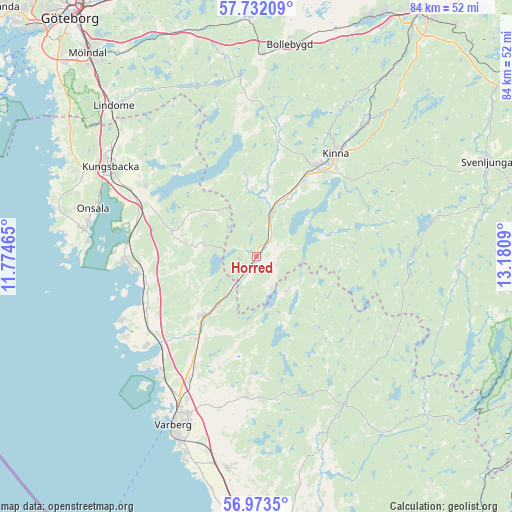
Horred GPS coordinates[2]
57° 21' 17.1" North, 12° 28' 39.972" East
| Map corner | latitude | longitude |
|---|---|---|
| Upper-left | 57.73209°, | 11.77465° |
| Center: | 57.35475°, | 12.47777° |
| Lower-right: | 56.9735°, | 13.1809° |
| Map W x H: | 84.3×84.3 km | = 52.4×52.4mi |
| max Lat: | 67.85572° ⇑74% North |
| Horred: | 57.35475° |
| min Lat: | ⇓26% South 55.34337° |
| min Long | Horred | max Long |
| 11.1712° | 12.47777° | 24.13676° |
| W 11.4%⇐ | ⇒88.6% E |
Elevation
Elevation of Horred is 27 m = 89 ft, and this is 55.6 m = 182 ft below average elevation for this country.
| Max E: |
663 m = 2175 ft | 67.8% |
| Avg. | 82.6 m = 271 ft | |
| Horred | 27 m = 89 ft | |
Min E: |
-1 m = -3 ft | 32.2% |
See also: Sweden elevation on elevation.city.
Geographical zone
Horred is located in North temperate zone (between Tropic of Cancer and the Arctic Circle). Distance of this North polar circle is 1023.9 km =636.2 mi to North.| Distance of | km | miles | from Horred |
|---|---|---|---|
| North Pole | 3629.8 | 2255.5 | to North |
| Arctic Circle | 1023.9 | 636.2 | to North |
| Tropic Cancer | 3771.3 | 2343.4 | to South |
| Equator | 6377.3 | 3962.7 | to South |


Nearby cities:
15 places around Horred: (largest is in red/bold)
• Björketorp
8.5 km =5.3 mi,  19°
19°
• Bua
25 km =15.5 mi,  238°
238°
• Fjärås kyrkby
21.5 km =13.4 mi,  302°
302°
• Frillesås
19.1 km =11.9 mi,  257°
257°
• Hyssna
22.8 km =14.2 mi,  9°
9°
• Kinna
21.4 km =13.3 mi,  37°
37°
• Kläppa
19.2 km =11.9 mi,  271°
271°
• Rolfstorp
22.8 km =14.2 mi,  184°
184°
• Skällinge
19.1 km =11.9 mi, 182°
• Sätila
21 km =13 mi,  352°
352°
• Veddige
13.2 km =8.2 mi,  221°
221°
• Väröbacka
21.2 km =13.2 mi, 236°
• Årnäs
22.9 km =14.2 mi, 223°
• Åsa
21.7 km =13.5 mi, 268°
• Ölmanäs
23.4 km =14.5 mi, 272°
Sources, notices
• [Note1] Compared only with cities in Sweden existing in our database
• [Src1] Map data: © OpenStreetMap contributors (CC-BY-SA)
• [Src2] Other city data from geonames.org with taken over terms of usage.
• [Src3] Geographical zone / Annual Mean Temperature by Robert A. Rohde @ Wikipedia
