Veddige geodata
Veddige (Halland) is a populated place; located in Sweden in Europe/Stockholm (GMT+2) time zone. With population of 2,260 people, there are 482 cities with bigger population in this country. Compared to other cities in Sweden, 75% of cities are located further ↑North; 90% of cities are located further →East and 80.1% of cities have higher elevation than Veddige. Note1
Administrative division(s):
- Level 1: Halland
- Level 2: Varbergs Kommun
- Level 3: Veddige
- Level 4: Veddige socken


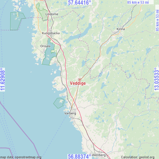
Veddige GPS coordinates[2]
57° 15' 57.276" North, 12° 19' 55.92" East
| Map corner | latitude | longitude |
|---|---|---|
| Upper-left | 57.64416°, | 11.62908° |
| Center: | 57.26591°, | 12.3322° |
| Lower-right: | 56.88374°, | 13.03533° |
| Map W x H: | 84.6×84.5 km | = 52.6×52.5mi |
| max Lat: | 67.85572° ⇑75% North |
| Veddige: | 57.26591° |
| min Lat: | ⇓25% South 55.34337° |
| min Long | Veddige | max Long |
| 11.1712° | 12.3322° | 24.13676° |
| W 10%⇐ | ⇒90% E |
Elevation
Elevation of Veddige is 16 m = 52 ft, and this is 66.6 m = 219 ft below average elevation for this country.
| Max E: |
663 m = 2175 ft | 80.1% |
| Avg. | 82.6 m = 271 ft | |
| Veddige | 16 m = 52 ft | |
Min E: |
-1 m = -3 ft | 19.9% |
See also: Sweden elevation on elevation.city.
Geographical zone
Veddige is located in North temperate zone (between Tropic of Cancer and the Arctic Circle). Distance of this North polar circle is 1033.8 km =642.4 mi to North.| Distance of | km | miles | from Veddige |
|---|---|---|---|
| North Pole | 3639.7 | 2261.6 | to North |
| Arctic Circle | 1033.8 | 642.4 | to North |
| Tropic Cancer | 3761.5 | 2337.3 | to South |
| Equator | 6367.4 | 3956.5 | to South |


Nearby cities:
15 places around Veddige: (largest is in red/bold)
• Björketorp
21.3 km =13.2 mi,  32°
32°
• Bua
13 km =8.1 mi,  256°
256°
• Frillesås
11.4 km =7.1 mi,  299°
299°
• Horred
13.2 km =8.2 mi,  41°
41°
• Kläppa
14.8 km =9.2 mi,  314°
314°
• Rolfstorp
14.7 km =9.1 mi,  151°
151°
• Skällinge
12.2 km =7.6 mi,  138°
138°
• Trönninge
13.7 km =8.5 mi,  190°
190°
• Trönningenäs
15.5 km =9.6 mi,  204°
204°
• Tångaberg
12 km =7.5 mi,  211°
211°
• Varberg
18.5 km =11.5 mi, 195°
• Väröbacka
9.1 km =5.7 mi, 258°
• Årnäs
9.8 km =6.1 mi,  227°
227°
• Åsa
16 km =9.9 mi, 305°
• Ölmanäs
18.2 km =11.3 mi, 306°
Sources, notices
• [Note1] Compared only with cities in Sweden existing in our database
• [Src1] Map data: © OpenStreetMap contributors (CC-BY-SA)
• [Src2] Other city data from geonames.org with taken over terms of usage.
• [Src3] Geographical zone / Annual Mean Temperature by Robert A. Rohde @ Wikipedia
