Hortlax geodata
Hortlax (Norrbotten) is a populated place; located in Sweden in Europe/Stockholm (GMT+2) time zone. With population of 1,128 people, there are 763 cities with bigger population in this country. Compared to other cities in Sweden, 96.3% of cities are located further ↓South; 97.6% of cities are located further ←West and 88.4% of cities have higher elevation than Hortlax. Note1


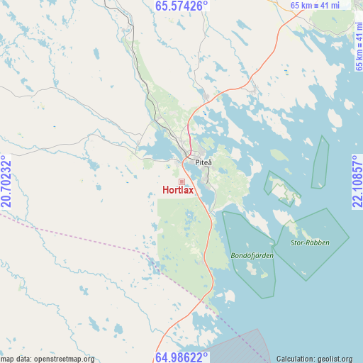
Hortlax GPS coordinates[2]
65° 16' 54.768" North, 21° 24' 19.584" East
| Map corner | latitude | longitude |
|---|---|---|
| Upper-left | 65.57426°, | 20.70232° |
| Center: | 65.28188°, | 21.40544° |
| Lower-right: | 64.98622°, | 22.10857° |
| Map W x H: | 65.4×65.4 km | = 40.6×40.6mi |
| max Lat: | 67.85572° ⇑3.7% North |
| Hortlax: | 65.28188° |
| min Lat: | ⇓96.3% South 55.34337° |
| min Long | Hortlax | max Long |
| 11.1712° | 21.40544° | 24.13676° |
| W 97.6%⇐ | ⇒2.4% E |
Elevation
Elevation of Hortlax is 10 m = 33 ft, and this is 72.6 m = 238 ft below average elevation for this country.
| Max E: |
663 m = 2175 ft | 88.4% |
| Avg. | 82.6 m = 271 ft | |
| Hortlax | 10 m = 33 ft | |
Min E: |
-1 m = -3 ft | 11.6% |
See also: Sweden elevation on elevation.city.
Geographical zone
Hortlax is located in North temperate zone (between Tropic of Cancer and the Arctic Circle). Distance of this North polar circle is 142.5 km =88.5 mi to North.| Distance of | km | miles | from Hortlax |
|---|---|---|---|
| North Pole | 2748.4 | 1707.8 | to North |
| Arctic Circle | 142.5 | 88.5 | to North |
| Tropic Cancer | 4652.7 | 2891.1 | to South |
| Equator | 7258.7 | 4510.3 | to South |


Nearby cities:
15 places around Hortlax: (largest is in red/bold)
• Alvik
31 km =19.3 mi,  32°
32°
• Antnäs
36.3 km =22.6 mi, 33°
• Backa
36.8 km =22.9 mi,  205°
205°
• Bergsviken
2.3 km =1.4 mi,  332°
332°
• Byske
37.8 km =23.5 mi,  194°
194°
• Jävre
15.1 km =9.4 mi,  166°
166°
• Måttsund
37.6 km =23.4 mi,  37°
37°
• Norrfjärden
15.8 km =9.8 mi,  16°
16°
• Piteå
5.2 km =3.2 mi, 41°
• Roknäs
12.2 km =7.6 mi,  308°
308°
• Rosvik
21.7 km =13.5 mi, 39°
• Stensjön
36.1 km =22.4 mi,  203°
203°
• Storvik
34.6 km =21.5 mi,  244°
244°
• Svartå
40.7 km =25.3 mi,  227°
227°
• Ånäset
30.6 km =19 mi, 307°
Sources, notices
• [Note1] Compared only with cities in Sweden existing in our database
• [Src1] Map data: © OpenStreetMap contributors (CC-BY-SA)
• [Src2] Other city data from geonames.org with taken over terms of usage.
• [Src3] Geographical zone / Annual Mean Temperature by Robert A. Rohde @ Wikipedia
