Žužemberk geodata
Žužemberk is a seat of a first-order administrative division; located in Slovenia in Europe/Ljubljana (GMT+2) time zone. With population of 1,053 people, there are 203 cities with bigger population in this country. Compared to other cities in Slovenia, 87% of cities are located further ↑North; 52.2% of cities are located further →East and 73.3% of cities have higher elevation than Žužemberk. Note1


Žužemberk GPS coordinates[2]
45° 50' 2.004" North, 14° 55' 45.012" East
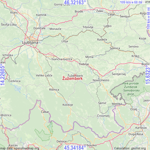
| Map corner | latitude | longitude |
|---|---|---|
| Upper-left | 46.32163°, | 14.22605° |
| Center: | 45.83389°, | 14.92917° |
| Lower-right: | 45.34184°, | 15.6323° |
| Map W x H: | 108.9×108.9 km | = 67.7×67.7mi |
| max Lat: | 46.83694° ⇑87% North |
| Žužemberk: | 45.83389° |
| min Lat: | ⇓13% South 45.47667° |
| min Long | Žužemberk | max Long |
| 13.52639° | 14.92917° | 16.4975° |
| W 47.8%⇐ | ⇒52.2% E |
Elevation
Elevation of Žužemberk is 233 m = 764 ft, and this is 92.6 m = 304 ft below average elevation for this country.
| Max E: |
1551 m = 5089 ft | 73.3% |
| Avg. | 325.6 m = 1068 ft | |
| Žužemberk | 233 m = 764 ft | |
Min E: |
2 m = 7 ft | 26.7% |
See also: Slovenia elevation on elevation.city.
Geographical zone
Žužemberk is located in North temperate zone (between Tropic of Cancer and the Arctic Circle). Distance of this North polar circle is 2304.9 km =1432.2 mi to North.| Distance of | km | miles | from Žužemberk |
|---|---|---|---|
| North Pole | 4910.8 | 3051.4 | to North |
| Arctic Circle | 2304.9 | 1432.2 | to North |
| Tropic Cancer | 2490.3 | 1547.4 | to South |
| Equator | 5096.3 | 3166.7 | to South |


Nearby cities:
15 places around Žužemberk: (largest is in red/bold)
• Dolenja Vas
19.6 km =12.2 mi,  223°
223°
• Dolenjske Toplice
13.2 km =8.2 mi,  130°
130°
• Ivančna Gorica
15.1 km =9.4 mi,  320°
320°
• Mirna
17 km =10.6 mi,  37°
37°
• Mirna Peč
12.3 km =7.6 mi,  76°
76°
• Mokronog
19.8 km =12.3 mi,  55°
55°
• Novo Mesto
18.9 km =11.7 mi,  100°
100°
• Ribnica
18.9 km =11.7 mi,  235°
235°
• Slovenska Vas
18.5 km =11.5 mi, 42°
• Stična
16.8 km =10.4 mi,  326°
326°
• Straža
12.6 km =7.8 mi,  118°
118°
• Trebnje
10.6 km =6.6 mi, 42°
• Videm
18.3 km =11.4 mi,  275°
275°
• Višnja Gora
19.5 km =12.1 mi,  313°
313°
• Šentvid pri Stični
14.5 km =9 mi, 332°
Sources, notices
• [Note1] Compared only with cities in Slovenia existing in our database
• [Src1] Map data: © OpenStreetMap contributors (CC-BY-SA)
• [Src2] Other city data from geonames.org with taken over terms of usage.
• [Src3] Geographical zone / Annual Mean Temperature by Robert A. Rohde @ Wikipedia
