Slovenska Vas geodata
Slovenska Vas (Šentrupert) is a populated place; located in Slovenia in Europe/Ljubljana (GMT+2) time zone. With population of 549 people, there are 484 cities with bigger population in this country. Compared to other cities in Slovenia, 77.8% of cities are located further ↑North; 54.5% of cities are located further ←West and 69.2% of cities have higher elevation than Slovenska Vas. Note1


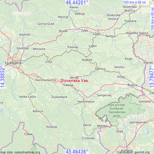
Slovenska Vas GPS coordinates[2]
45° 57' 19.224" North, 15° 5' 29.904" East
| Map corner | latitude | longitude |
|---|---|---|
| Upper-left | 46.44201°, | 14.38852° |
| Center: | 45.95534°, | 15.09164° |
| Lower-right: | 45.46436°, | 15.79477° |
| Map W x H: | 108.7×108.7 km | = 67.5×67.5mi |
| max Lat: | 46.83694° ⇑77.8% North |
| Slovenska Vas: | 45.95534° |
| min Lat: | ⇓22.2% South 45.47667° |
| min Long | Slovenska Vas | max Long |
| 13.52639° | 15.09164° | 16.4975° |
| W 54.5%⇐ | ⇒45.5% E |
Elevation
Elevation of Slovenska Vas is 245 m = 804 ft, and this is 80.6 m = 264 ft below average elevation for this country.
| Max E: |
1551 m = 5089 ft | 69.2% |
| Avg. | 325.6 m = 1068 ft | |
| Slovenska Vas | 245 m = 804 ft | |
Min E: |
2 m = 7 ft | 30.8% |
See also: Slovenia elevation on elevation.city.
Geographical zone
Slovenska Vas is located in North temperate zone (between Tropic of Cancer and the Arctic Circle). Distance of this North polar circle is 2291.4 km =1423.8 mi to North.| Distance of | km | miles | from Slovenska Vas |
|---|---|---|---|
| North Pole | 4897.3 | 3043 | to North |
| Arctic Circle | 2291.4 | 1423.8 | to North |
| Tropic Cancer | 2503.8 | 1555.8 | to South |
| Equator | 5109.8 | 3175.1 | to South |


Nearby cities:
15 places around Slovenska Vas: (largest is in red/bold)
• Dolenji Boštanj
16.5 km =10.3 mi,  68°
68°
• Krmelj
8.2 km =5.1 mi, 66°
• Mirna
2.3 km =1.4 mi,  269°
269°
• Mirna Peč
10.6 km =6.6 mi,  183°
183°
• Mokronog
4.5 km =2.8 mi,  121°
121°
• Novo Mesto
17.9 km =11.1 mi,  160°
160°
• Otočec
16.5 km =10.3 mi,  141°
141°
• Radeče
14.4 km =8.9 mi,  29°
29°
• Sevnica
18.3 km =11.4 mi, 71°
• Trebnje
7.9 km =4.9 mi,  223°
223°
• Šentrupert
2.5 km =1.6 mi,  6°
6°
• Škocjan
16.4 km =10.2 mi,  109°
109°
• Šmarjeta
14.6 km =9.1 mi, 123°
• Šmarješke Toplice
14.4 km =8.9 mi, 135°
• Žužemberk
18.5 km =11.5 mi, 222°
Sources, notices
• [Note1] Compared only with cities in Slovenia existing in our database
• [Src1] Map data: © OpenStreetMap contributors (CC-BY-SA)
• [Src2] Other city data from geonames.org with taken over terms of usage.
• [Src3] Geographical zone / Annual Mean Temperature by Robert A. Rohde @ Wikipedia
