Lukavci geodata
Lukavci (Križevci) is a populated place; located in Slovenia in Europe/Ljubljana (GMT+2) time zone. With population of 630 people, there are 411 cities with bigger population in this country. Compared to other cities in Slovenia, 83.7% of cities are located further ↓South; 92.7% of cities are located further ←West and 85.8% of cities have higher elevation than Lukavci. Note1


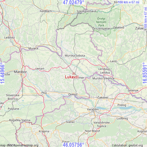
Lukavci GPS coordinates[2]
46° 32' 35.988" North, 16° 9' 10.008" East
| Map corner | latitude | longitude |
|---|---|---|
| Upper-left | 47.02479°, | 15.44966° |
| Center: | 46.54333°, | 16.15278° |
| Lower-right: | 46.05756°, | 16.85591° |
| Map W x H: | 107.5×107.5 km | = 66.8×66.8mi |
| max Lat: | 46.83694° ⇑16.3% North |
| Lukavci: | 46.54333° |
| min Lat: | ⇓83.7% South 45.47667° |
| min Long | Lukavci | max Long |
| 13.52639° | 16.15278° | 16.4975° |
| W 92.7%⇐ | ⇒7.3% E |
Elevation
Elevation of Lukavci is 177 m = 581 ft, and this is 148.6 m = 488 ft below average elevation for this country.
| Max E: |
1551 m = 5089 ft | 85.8% |
| Avg. | 325.6 m = 1068 ft | |
| Lukavci | 177 m = 581 ft | |
Min E: |
2 m = 7 ft | 14.2% |
See also: Slovenia elevation on elevation.city.
Geographical zone
Lukavci is located in North temperate zone (between Tropic of Cancer and the Arctic Circle). Distance of this North polar circle is 2226 km =1383.2 mi to North.| Distance of | km | miles | from Lukavci |
|---|---|---|---|
| North Pole | 4831.9 | 3002.4 | to North |
| Arctic Circle | 2226 | 1383.2 | to North |
| Tropic Cancer | 2569.2 | 1596.4 | to South |
| Equator | 5175.1 | 3215.7 | to South |


Nearby cities:
15 places around Lukavci: (largest is in red/bold)
• Bakovci
8.4 km =5.2 mi,  358°
358°
• Beltinci
9.6 km =6 mi,  44°
44°
• Bratonci
9.7 km =6 mi,  31°
31°
• Cven
5.1 km =3.2 mi,  85°
85°
• Dokležovje
6.9 km =4.3 mi,  16°
16°
• Dolnja Bistrica
10.4 km =6.5 mi, 92°
• Gornja Bistrica
9.1 km =5.7 mi,  73°
73°
• Ižakovci
7.3 km =4.5 mi,  45°
45°
• Križevci pri Ljutomeru
3 km =1.9 mi,  338°
338°
• Ljutomer
4.2 km =2.6 mi,  126°
126°
• Melinci
7.2 km =4.5 mi,  62°
62°
• Razkrižje
10.1 km =6.3 mi,  103°
103°
• Sveti Jurij ob Ščavnici
10.3 km =6.4 mi,  286°
286°
• Sveti Tomaž
8.4 km =5.2 mi,  218°
218°
• Veržej
4.6 km =2.9 mi,  12°
12°
Sources, notices
• [Note1] Compared only with cities in Slovenia existing in our database
• [Src1] Map data: © OpenStreetMap contributors (CC-BY-SA)
• [Src2] Other city data from geonames.org with taken over terms of usage.
• [Src3] Geographical zone / Annual Mean Temperature by Robert A. Rohde @ Wikipedia
