Lovrenc na Pohorju geodata
Lovrenc na Pohorju is a seat of a first-order administrative division; located in Slovenia in Europe/Ljubljana (GMT+2) time zone. With population of 1,977 people, there are 105 cities with bigger population in this country. Compared to other cities in Slovenia, 83% of cities are located further ↓South; 66.3% of cities are located further ←West and 78.8% of cities have lower elevation than Lovrenc na Pohorju. Note1


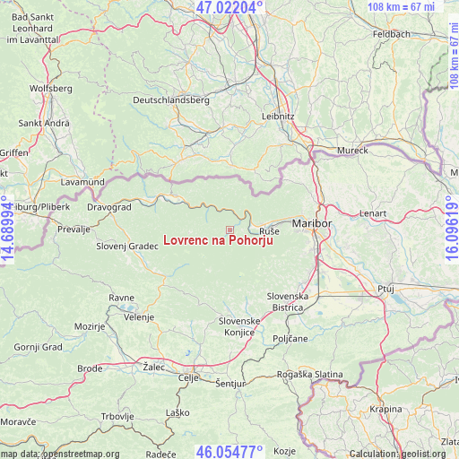
Lovrenc na Pohorju GPS coordinates[2]
46° 32' 26.016" North, 15° 23' 35.016" East
| Map corner | latitude | longitude |
|---|---|---|
| Upper-left | 47.02204°, | 14.68994° |
| Center: | 46.54056°, | 15.39306° |
| Lower-right: | 46.05477°, | 16.09619° |
| Map W x H: | 107.6×107.5 km | = 66.9×66.8mi |
| max Lat: | 46.83694° ⇑17% North |
| Lovrenc na Pohorju: | 46.54056° |
| min Lat: | ⇓83% South 45.47667° |
| min Long | Lovrenc na Poho | max Long |
| 13.52639° | 15.39306° | 16.4975° |
| W 66.3%⇐ | ⇒33.7% E |
Elevation
Elevation of Lovrenc na Pohorju is 421 m = 1381 ft, and this is 95.4 m = 313 ft above average elevation for this country.
| Max E: |
1551 m = 5089 ft | 21.2% |
| Lovrenc na Pohorju | 421 m 1381 ft | |
| Avg. | 325.6 m = 1068 ft | |
Min E: |
2 m = 7 ft | 78.8% |
See also: Slovenia elevation on elevation.city.
Geographical zone
Lovrenc na Pohorju is located in North temperate zone (between Tropic of Cancer and the Arctic Circle). Distance of this North polar circle is 2226.3 km =1383.4 mi to North.| Distance of | km | miles | from Lovrenc na Pohorju |
|---|---|---|---|
| North Pole | 4832.2 | 3002.6 | to North |
| Arctic Circle | 2226.3 | 1383.4 | to North |
| Tropic Cancer | 2568.9 | 1596.2 | to South |
| Equator | 5174.8 | 3215.5 | to South |


Nearby cities:
15 places around Lovrenc na Pohorju: (largest is in red/bold)
• Bezena
10.8 km =6.7 mi,  85°
85°
• Bistrica ob Dravi
12 km =7.5 mi,  82°
82°
• Bresternica
14.3 km =8.9 mi, 76°
• Hrastje
13.8 km =8.6 mi, 94°
• Kamnica
17.3 km =10.7 mi, 77°
• Limbuš
14.6 km =9.1 mi, 84°
• Oplotnica
17.5 km =10.9 mi,  166°
166°
• Pekre
15.5 km =9.6 mi, 87°
• Podvelka
7 km =4.3 mi,  317°
317°
• Radlje ob Dravi
15.1 km =9.4 mi,  302°
302°
• Ribnica na Pohorju
9.2 km =5.7 mi,  266°
266°
• Ruše
9.4 km =5.8 mi, 90°
• Selnica ob Dravi
7.9 km =4.9 mi, 82°
• Spodnji Slemen
11.1 km =6.9 mi,  74°
74°
• Vuhred
13.3 km =8.3 mi, 296°
Sources, notices
• [Note1] Compared only with cities in Slovenia existing in our database
• [Src1] Map data: © OpenStreetMap contributors (CC-BY-SA)
• [Src2] Other city data from geonames.org with taken over terms of usage.
• [Src3] Geographical zone / Annual Mean Temperature by Robert A. Rohde @ Wikipedia
