Radlje ob Dravi geodata
Radlje ob Dravi is a seat of a first-order administrative division; located in Slovenia in Europe/Ljubljana (GMT+2) time zone. With population of 2,811 people, there are 75 cities with bigger population in this country. Compared to other cities in Slovenia, 92.7% of cities are located further ↓South; 62.2% of cities are located further ←West and 69% of cities have lower elevation than Radlje ob Dravi. Note1


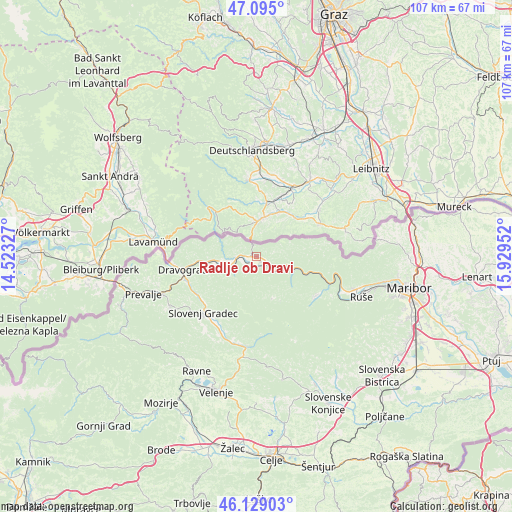
Radlje ob Dravi GPS coordinates[2]
46° 36' 51.012" North, 15° 13' 35.004" East
| Map corner | latitude | longitude |
|---|---|---|
| Upper-left | 47.095°, | 14.52327° |
| Center: | 46.61417°, | 15.22639° |
| Lower-right: | 46.12903°, | 15.92952° |
| Map W x H: | 107.4×107.4 km | = 66.7×66.7mi |
| max Lat: | 46.83694° ⇑7.3% North |
| Radlje ob Dravi: | 46.61417° |
| min Lat: | ⇓92.7% South 45.47667° |
| min Long | Radlje ob Dravi | max Long |
| 13.52639° | 15.22639° | 16.4975° |
| W 62.2%⇐ | ⇒37.8% E |
Elevation
Elevation of Radlje ob Dravi is 366 m = 1201 ft, and this is 40.4 m = 133 ft above average elevation for this country.
| Max E: |
1551 m = 5089 ft | 31% |
| Radlje ob Dravi | 366 m 1201 ft | |
| Avg. | 325.6 m = 1068 ft | |
Min E: |
2 m = 7 ft | 69% |
See also: Slovenia elevation on elevation.city.
Geographical zone
Radlje ob Dravi is located in North temperate zone (between Tropic of Cancer and the Arctic Circle). Distance of this North polar circle is 2218.2 km =1378.3 mi to North.| Distance of | km | miles | from Radlje ob Dravi |
|---|---|---|---|
| North Pole | 4824.1 | 2997.6 | to North |
| Arctic Circle | 2218.2 | 1378.3 | to North |
| Tropic Cancer | 2577.1 | 1601.3 | to South |
| Equator | 5183 | 3220.6 | to South |


Nearby cities:
15 places around Radlje ob Dravi: (largest is in red/bold)
• Dravograd
16.1 km =10 mi,  259°
259°
• Gortina
7.7 km =4.8 mi, 263°
• Legen
13.5 km =8.4 mi,  207°
207°
• Lovrenc na Pohorju
15.1 km =9.4 mi,  122°
122°
• Muta
4.6 km =2.9 mi,  266°
266°
• Otiški Vrh
15.5 km =9.6 mi,  253°
253°
• Pameče
14.3 km =8.9 mi,  231°
231°
• Podvelka
8.5 km =5.3 mi,  110°
110°
• Ribnica na Pohorju
9.5 km =5.9 mi,  158°
158°
• Slovenj Gradec
16.1 km =10 mi,  223°
223°
• Vuhred
2.3 km =1.4 mi, 158°
• Vuzenica
4.9 km =3 mi, 246°
• Črneče
17.5 km =10.9 mi, 260°
• Šentjanž pri Dravogradu
15.5 km =9.6 mi, 247°
• Šmartno pri Slovenj Gradcu
16.6 km =10.3 mi, 213°
Sources, notices
• [Note1] Compared only with cities in Slovenia existing in our database
• [Src1] Map data: © OpenStreetMap contributors (CC-BY-SA)
• [Src2] Other city data from geonames.org with taken over terms of usage.
• [Src3] Geographical zone / Annual Mean Temperature by Robert A. Rohde @ Wikipedia
